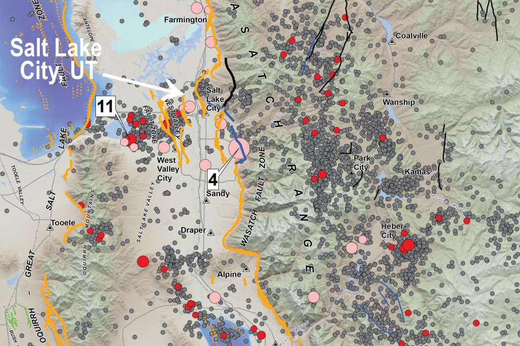
There is a 57% probability (over 1 in 2 chance) that a magnitude 6.0 or greater earthquake will occur in the Wasatch Front region in the next 50 years.

To address this threat, the Utah Earthquake Program consisting of the UGS, UUSS, and the UDEM, developed the map of Utah earthquakes and faults so the public could more fully understand the hazard from earthquakes and faults, as well as the resulting risk to property, infrastructure, and life safety in Utah.

April 19th is the Great Utah ShakeOut. Participating in this drill is a great way for your family or organization to be prepared to survive and recover quickly from an earthquake. For more information on the Great Utah ShakeOut visit https://www.shakeout.org/utah/.

For the entire month of April the Utah Earthquakes (1850-2016) and Quaternary Fault Map is on sale for $11.25 (reg. $15.00) at the Utah Department of Natural Resources Map & Bookstore, 1594 West North Temple in Salt Lake City. 

BUY ONLINE


UGS geologists participated in the Preparedness on the Hill event yesterday at the State Capitol. Governor Herbert stopped by and discussed earthquake hazards in Utah, and Steve Bowman explained the newly released “Utah Earthquakes (1850–2016) and Quaternary Faults” map. Photo courtesy of the Division of Emergency Management.

Geologists Day is celebrated annually on the first Sunday of April throughout the world.

Outcrop of the Mississippian/Pennsylvanian Manning Canyon Shale in Soldier Canyon, Oquirrh Mountains, Tooele County, Utah. Utah Geological Survey geologists Craig Morgan, Taylor Boden, and Stephanie Carney are measuring, describing, and sampling the Manning Canyon stratigraphic section.

The Natural Resources Map & Bookstore is the place to research your next outdoor adventure. It specializes in maps and guides for outdoor recreation including hiking, off-highway vehicles, rockhounding, hunting, fishing, and other activities. It’s the state’s official source for more than 1,500 USGS topographic maps, and can print on demand any of the more than 55,000 topographic maps for the entire United States.

There is also unique collection of Utah-centric books on history and folklore, birds, flowers, outdoor survival, treasure hunting, wild game and outdoor cooking, petroglyphs, and more. Come browse through the large selection of maps and books for all Utah outdoor enthusiasts published by DNR divisions as well as private publishers.

UGS geologists participated in the Preparedness on the Hill event yesterday at the State Capitol. Governor Herbert stopped by and discussed earthquake hazards in Utah, and Steve Bowman explained the newly released “Utah Earthquakes (1850–2016) and Quaternary Faults” map. Photo courtesy of the Division of Emergency Management.