
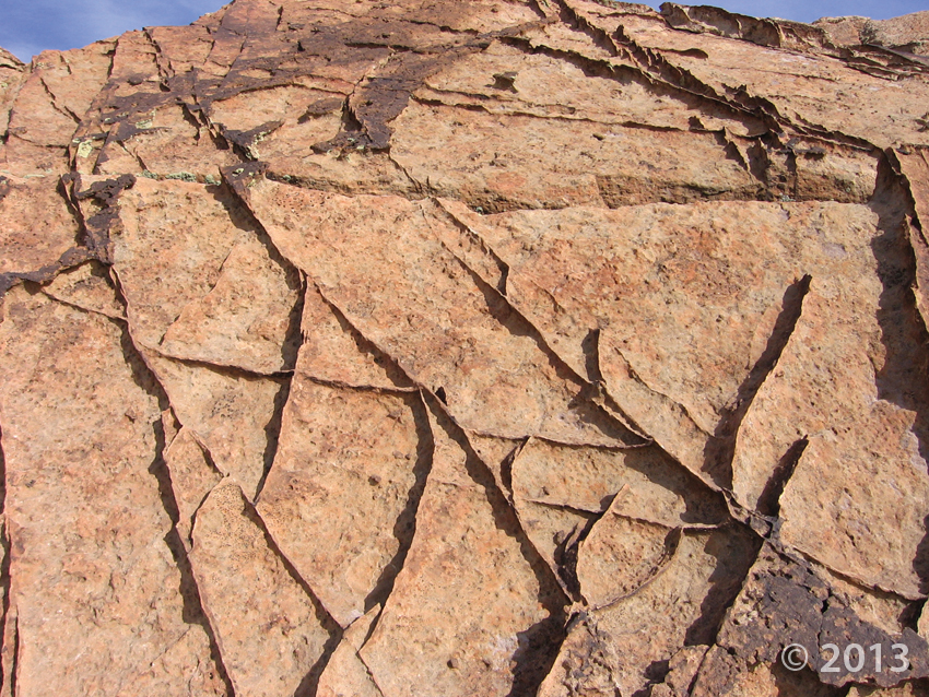
Deformation bands, Aneth oil field, San Juan County, Utah
Photographer: Craig Morgan; © 2013
Deformation bands, Aneth oil field, San Juan County, Utah
Photographer: Craig Morgan; © 2013
‘Arches’ glad we shared these stunning photos with you? Have a great Monday, everyone!
livescience.com
Check out these stunning photos of natural sandstone arches in the American Southwest. These incredible geological formations are a reminder of the power and beauty of nature.
Trilobites are always a fun find when you’re exploring the outdoors, but how much do you know about Trilobites as living organisms? Maybe you’re just interested in finding your own Trilobite fossils. Read more about the little critters in our “Glad You Asked” article HERE!
Catch this NOVA special on landslides tonight on KUED Channel 7 at 8:00 tonight.
kued.org
In less than two minutes in March, a one-square-mile field of debris slammed into the Washington state community of Oso, killing 41 and destroying nearly 50 homes. Drawing on analysis of other recent landslides around the world, geologists are investigating what triggered the deadliest U.S. landslide in decades and whether climate change is increasing the risk of similar disasters around the globe.

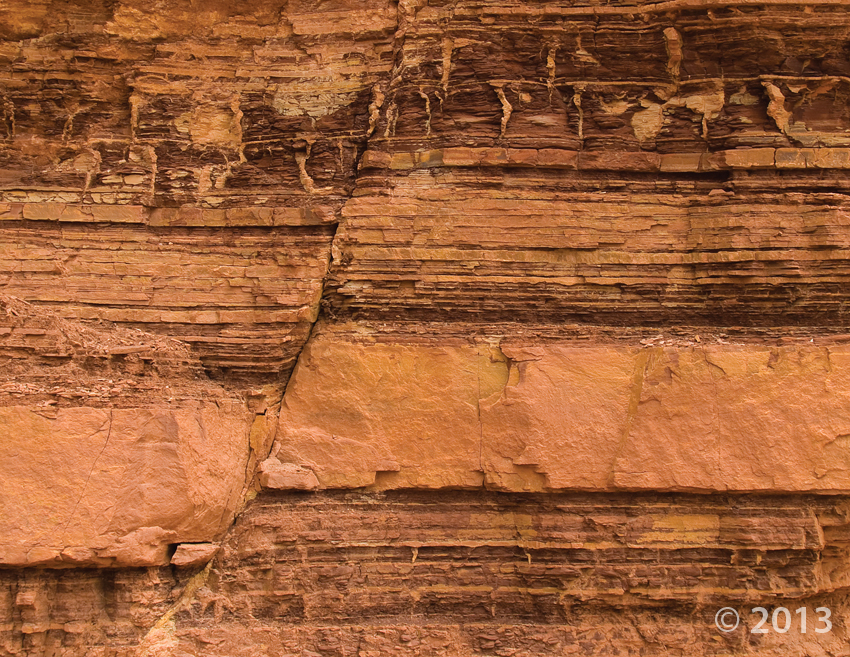
Small fault in the Moenkopi Formation, San Rafael Swell, Emery County, Utah
Photographer: Michael Vanden Berg; © 2013
One of our Utah Geological Survey geologists, Robert Biek, is an author on the newly discovered Markagunt gravity slide. Located in Utah, the slide has come to be found as one of the world’s largest known landslides (tied for largest, alongside the Heart Mountain gravity slide in northwest Wyoming). Read more about it!
arstechnica.com
Some things can be too big to notice, as our flat-Earth-believing ancestors can attest, having failed to work out that the surface of the Earth curves around a sphere. Or, as the saying goes, you can focus on the details of some fascinating trees and miss interesting facts about the forest as a whole.
Check it out! KSL came by as the big dinosaur fossil block was getting dropped off at UGS last week. The block is believed to contain a group of Utahraptors trapped together in quicksand.
ksl.com
A massive dinosaur discovery was left sitting in a parking lot Thursday night.

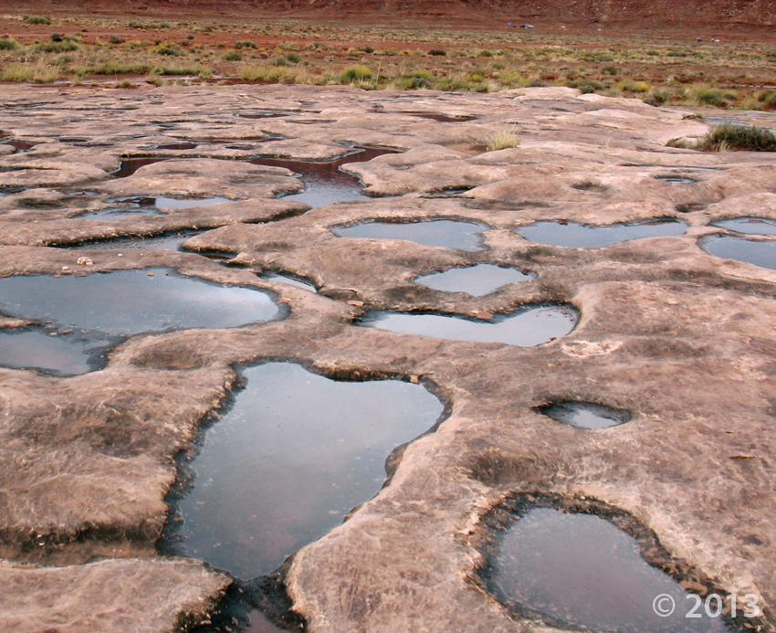
Canyonlands National Park, San Juan County, Utah
Photographer: Don DeBlieux; © 2013
Water-filled potholes in the White Rim Sandstone, Canyonlands National Park, San Juan County.
deseretnews.com
Patrons will have an opportunity to view the ancient artifacts and rare scientific collections behind the scenes at the Natural History Museum of Utah, in a special event on Saturday and Sunday, Nov. 15-16.
hcn.org
LIDAR, or Light Detection and Ranging, uses lasers to create intricate three-dimensional maps in places where bad weather or thick vegetation hampered traditional aerial mapping. Though the technology itself isn’t new, it’s about to become more widespread: The 3D Elevation Program, a billion-dollar initiative launched this summer by the U.S. Geological Survey and numerous partners, seeks to remap the country using LIDAR — and make the maps public. “There doesn’t seem to be a limit to how creative people can use this technology,” says Kevin Gallagher, associate director for USGS Core Science Systems. “It’s like looking at the world through a new pair of glasses.”
![]()
The Utah Geological Survey (UGS) is a division of the Utah Department of Natural Resources. Several specialized programs comprise the UGS: Data Management, Energy & Minerals, Geologic Hazards, Geologic Information & Outreach, Geologic Mapping, Groundwater & Wetlands, and Paleontology.