
Along the Colorado River, Grand County
Photographer: Ryhan Sempler © 2016
Geologic map of Dugway Proving Ground and adjacent areas, Tooele County, Utah.
By: Donald L. Clark, Charles G. Oviatt, and David Page
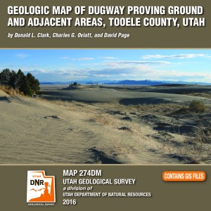
Dugway Proving Ground is an expansive military installation that covers parts of the southern Great Salt Lake Desert and Government Creek Basin, and the southern Cedar Mountains, Wildcat Mountain, Granite Peak, and northern Dugway Range. The ranges contain Paleozoic marine sedimentary rocks about 28,000 feet (8540 m) thick, excepting Granite Peak- a Late Jurassic granitic intrusion. The southern Cedar Mountains volcanic field contains Eocene intermediate to silicic rocks, while the rhyolitic Sapphire Mountain lava flow is Miocene. Paleozoic rock packages are distributed among at least three thrusts sheets of the Sevier fold-thrust belt (Cretaceous to Eocene). Regional extension since about 20 million years ago has broken the area into basins and ranges along high-angle normal faults. Quaternary surficial deposits originated from the Bonneville lake cycle, and alluvial, eolian, and mixed environments. A unique feature is the Old River Bed and associated delta complex at its northern terminus, related to surface- water overflow and goundwater discharge from the Sevier basin to the Great Salt Lake basin between about 15,000 and 10,000 years ago. The delta was occupied by prehistoric humans.

By: James C. Coogan and Jon K. King
The Ogden 30’x60′ quadrangle covers the populous Wasatch Front near Ogden, Utah, and the adjacent Wasatch Range, and extends eastward into Wyoming near Evanston, Wyoming. It covers parts of the Ogden, Weber, and upper and lower Bear River drainages. The Ogden quadrangle is economically important because of the gas and oil fields on the east margin of the map area, the cement plant near Devils Slide, numerous sand and gravel operations, water resources, and recreational interests.
ksl.com
PANGUITCH — Imagine a landslide involving a sheet of rock about 1 mile thick and larger than the entire state of Rhode Island traveling across the landscape at speeds up to 200 mph.


Gooseberry Mesa, Washington County, Utah
Photographer: J. Lucy Jordan; © 2016
Sunset on Gooseberry Mesa shines golden light on cliffs of Triassic-age Shinarump Conglomerate and the underlying slope-forming Moenkopi Formation. White cliffs and peaks in the distance are thrones and temples of Zion National Park, formed of Jurassic-age Navajo Sandstone.


Alstrom Point, Kane County, Utah
Photographer: Marshall Robinson; © 2016
Lake Powell’s Gunsight Bay as seen from Alstrom Point, Kane County.


Happy Canyon, Garfield County, Utah
Photographer: Gregg Beukelman; © 2016
Just above its confluence with the Dirty Devil River, Happy Canyon deeply and abruptly cuts and sculpts the White Rim Sandstone of the Permian-age Cutler Formation.


Wasatch Range east of Layton, Davis County, Utah
Photographer: Ken Krahulec; © 2016

Little Grand Canyon of the San Rafael River, Emery County, Utah
Photographer: Zach Anderson; © 2016
Short days and low winter sun cause ice to form along the San Rafael River where it cuts through the west flank of the San Rafael Swell. The 1,100-foot-deep canyon exposes the Jurassic-Triassic-age Glen Canyon Group along the cliffs and ledges of the canyon walls.


Bells Canyon, Wasatch Range, Salt Lake County, Utah
Photographer: Jim Davis; © 2015
Lower Bells Canyon Reservoir and glacially sculpted Bells Canyon, Wasatch Range, Salt Lake County.
![]()
The Utah Geological Survey (UGS) is a division of the Utah Department of Natural Resources. Several specialized programs comprise the UGS: Data Management, Energy & Minerals, Geologic Hazards, Geologic Information & Outreach, Geologic Mapping, Groundwater & Wetlands, and Paleontology.