
We recently mapped part of the upper Bear River watershed using the National Wetland Inventory (NWI) Program’s mapping standards and the Cowardin classification system.
We recently mapped part of the upper Bear River watershed using the National Wetland Inventory (NWI) Program’s mapping standards and the Cowardin classification system.

Moqui marbles are small, brownish-black balls composed of iron oxide and sandstone that formed underground when iron minerals precipitated from flowing groundwater.

The Uinta Mountains are one of Utah’s premier mountain ranges. Rising above the Uinta Basin in Utah on the south and the Green River Basin in Wyoming on the north, they stretch from near Kamas eastward into northwestern Colorado. However, the Uintas are a tale of two geographies, so much so that many people refer to the “western (or high) Uintas” and the “eastern Uintas.”

Geologists generally know the age of a rock by determining the age of the group of rocks, or formation, that it is found in. The age of formations is marked on a geologic calendar known as the geologic time scale. Development of the geologic time scale and dating of formations and rocks relies upon two fundamentally different ways of telling time: relative and absolute.

The Wasatch fault zone has long been known to be a serious earthquake threat to the Wasatch Front region. However, another possible source of large (approximately magnitude [M] 6.5) earthquakes lies just a few miles west of Salt Lake City—the West Valley fault zone, comprising a system of faults on the floor of northern Salt Lake Valley.

Whether you can keep a fossil or not depends on 1) the type of fossil, and 2) who owns or manages the land where the fossil was found.

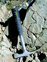
Fantasy Canyon is crowded with intricate and peculiar stone figures that are a unique expression of rock weathering and erosion. Covering only a few acres, this miniature canyon can be viewed up-close on a short 0.6-mile loop trail.

You found a strange rock. It is heavy, dark-colored, and magnetic; so you are thinking it must be from outer space. You visualize it falling through the air in a blaze and landing right where you are. Let’s do a reality check. The odds of finding a meteorite are slim even if you see it fall. Most disintegrate before reaching the ground.
Most people have never seen a fulgurite, and many that have probably did not realize what it was at the time. Fulgurites are natural tubes or crusts of glass formed by the fusion of silica (quartz) sand or rock from a lightning strike. Their shape mimics the path of the lightning bolt as it disperses into the ground.

The importance of minerals in everyday life is hardly recognized by the vast majority of people. To help illustrate how important minerals are to us, perhaps a trip through a normal working day of a geologist will better explain our reliance on minerals.
![]()
The Utah Geological Survey (UGS) is a division of the Utah Department of Natural Resources. Several specialized programs comprise the UGS: Data Management, Energy & Minerals, Geologic Hazards, Geologic Information & Outreach, Geologic Mapping, Groundwater & Wetlands, and Paleontology.