Yellowstone Basin, Uinta Mountains, Duchesne County
Photographer: Rich Emerson © 2017
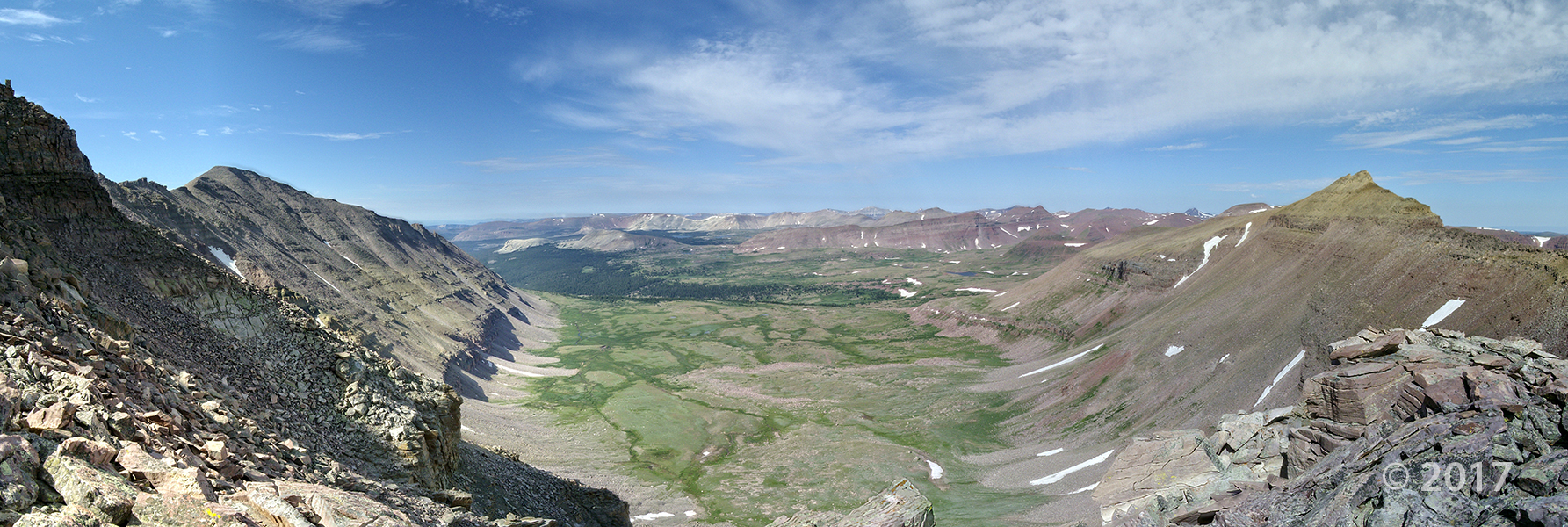
Yellowstone Basin, Uinta Mountains, Duchesne County
Photographer: Rich Emerson © 2017
Tower of Babel, Arches National Park, Grand County
Photographer: Kent Brown © 2017

Modern dunes, Arches National Park
Photographer: Kent Brown © 2017

Modern dunes (foreground) consist of sand weathered from bedrock such as the Wingate Sandstone (skyline), which similarly formed from sand deposited in dunes 200 million years ago.
Little Cottonwood Canyon, Salt Lake County
Photographer: Adam McKean © 2017

Interbedded shale and quartzite of the Precambrian Big Cottonwood Formation are dramatically folded and faulted on the sheer face of Twin Peaks in Little Cottonwood Canyon. The intrusive Tertiary-age Little Cottonwood granite stock forms the light-gray, glaciated peaks in the distance.
Needles District, Canyonlands National Park, San Juan County
Photographer: J. Lucy Jordan © 2017

View east from Jackson Bottom along the Colorado River, Grand County.
Photographer: Brian Butler © 2017

Goblin Valley State Park
Photographer: Michael Vanden Berg © 2017

Early morning sun casts shadows on “goblins” formed within the Entrada Sandstone, which consists of sediment deposited 160 million years ago in tidal flats and coastal dunes. Erosion forms the goblins, leaving resistant sandstone boulders perched atop softer siltstone and shale layers that erode more quickly.
Arches National Park, Grand County
Photographer: Gregg Beukelman © 2017
Defying gravity, an estimated 3500-ton sandstone boulder of Jurassic-age Entrada Formation perches atop a pedestal of less resistant sandstone of the Dewey Bridge Member of the Carmel Formation and forms Balanced Rock at Arches National Park. Snow-capped peaks in the background are the La Sal Mountains, a Tertiary-age laccolith.

Thor’s Hammer, Bryce Canyon National State Park
Photographer: Grant Willis © 2017

Thor’s Hammer, named for the Norse God of Thunder who controlled the air and storms, is probably the best-known hoodoo in Bryce Canyon National Park, and is also the icon for the Utah Geological Survey logo. It formed as the result of differential weathering of sandstone and siltstone layers in the Claron Formation, with the softer layers weathering and eroding faster than the harder layers. The retreating escarpment that forms Bryce Canyon owes its existence to the Paunsaugunt fault, which elevated Powell Point in the distance, and which also “sank” the Sinking Ship in middle distance.
Little Cottonwood Canyon, Wasatch Range
Photographer: Mike Hylland © 2017

Devils Castle exposes tilted layers of limestone and dolomite of the Deseret, Gardison, and Fitchville Formations above Albion Basin at the head of Little Cottonwood Canyon. Discoveries of silver, gold, copper, lead, and zinc in the area led to establishment of the Little Cottonwood mining district and the town of Alta in the late 1800’s.

The Utah Geological Survey (UGS) is a division of the Utah Department of Natural Resources. Several specialized programs comprise the UGS: Data Management, Energy & Minerals, Geologic Hazards, Geologic Information & Outreach, Geologic Mapping, Groundwater & Wetlands, and Paleontology.
1594 West North Temple, Suite 3110
Salt Lake City, Utah 84116
801-537-3300 (phone)
801-537-3400 (fax)
Mailing Address:
PO BOX 146100
Salt Lake City, Utah 84114
Monday through Friday,
8 a.m. to 5 p.m.
![]()