Tag Archive for: New Publications


Contact
Tom Chidsey
801-537-3364
tomchidsey@utah.gov

Bulletin 138, Produced Water in the Uinta Basin, Utah: Evaluation of Reservoirs, Water Storage Aquifers, and Management Options

Salt Lake City (Nov. 29, 2017) — Oil and gas fields in the Uinta Basin of eastern Utah typically produce about 30 million barrels of oil and 325 billion cubic feet of natural gas annually. The hydrocarbon production also generates over 100 million barrels of saline non-potable water which requires disposal. A new Utah Geological Survey report addresses how to deal with this water.

Extensive drilling for gas in “tight” sandstones in the eastern part of the basin generates a need for water disposal, while in the central basin expanding enhanced oil recovery (EOR) programs, called waterflooding, creates a need for water. Although drilling activity is currently low in Utah, and elsewhere, due to depressed oil and gas prices, existing fields continue to produce. As wells mature, water production increases while oil and gas production decreases. In addition, oil and gas prices change depending on the economics of global market supply and demand. History has shown that these prices always rebound. The environmentally sound disposal of produced water affects the economics of the hydrocarbon resource development in the basin. Specific Uinta Basin water issues include water use/reuse for well drilling and completion (e.g., hydraulic fracturing), appropriate sites for disposal/reuse of water, development of systems to manage the produced water streams, and differing challenges for gas versus oil producers.

This new study by the Utah Geological Survey (UGS) covers the geology, chemistry, and best practices related to saline water production in the Uinta Basin. Specifically, it includes (1) descriptions and maps of Uinta Basin reservoirs and aquifers, (2) statistical trends of the basin’s water quality, (3) overviews of produced-water facilities, and (4) recommendations for the best management practices and options to deal with the produced water. Appendices provide complete data compilations either collected or generated as part of this study. The report provides a framework to address the divergent water uses and disposal interests of various stakeholders and will help industry, particularly small producers, and regulators make optimum management decisions. The report also offers sound scientific information to allay public concerns about the potential for drinking-water contamination from hydraulic fracturing and production operations.

The 279-page Utah Geological Survey Bulletin 138, Produced Water in the Uinta Basin, Utah: Evaluation of Reservoirs, Water Storage Aquifers, and Management Options, is available (PDF) for free download from the UGS website at geology.utah.gov. Print-on-demand copies are available for purchase from the Utah Department of Natural Resources Map and Bookstore, 1-888-UTAHMAP, www.mapstore.utah.gov.

This research was funded by the Research Partnership to Secure Energy for America (RPSEA) through the “Small Producers Program,” authorized by the U.S. Energy Policy Act of 2005, and the National Energy Technology Laboratory of the U.S. Department of Energy, with additional support from the UGS. The UGS also collaborated extensively with sister regulatory agencies within the Utah Department of Natural Resources (Division of Oil, Gas and Mining, Division of Water Rights, Division of Water Resources) and other agencies such as the Utah Division of Environmental Quality, U.S. Bureau of Land Management, and U.S. Environmental Protection Agency, as well as tribal authorities in the Uinta Basin. Participating industry partners were Anadarko Petroleum Corp., EOG Resources, Inc., QEP Resources, Inc., Wind River Resources, and Newfield Exploration.

The Utah Geological Survey, a division of the Utah Department of Natural Resources, provides timely scientific information about Utah’s geologic environment, resources, and hazards.

UGS_PRESS-RELEASE-HEADER


Media Contact

Utah Geological Survey
Tom Chidsey
801-537-3364
tomchidsey@utah.gov


New Report Provides Information and Maps to Help Keep Utah “The Place” to Find Oil

Salt Lake City (Jan. 18, 2017) — A new study by the Utah Geological Survey (UGS), Major Oil Plays in Utah and Vicinity, contains the critical maps, data and information to help Utah remain a significant petroleum contributor to the nation while reaping major benefits to the State’s economy for years to come.

The study comes at time of low drilling activity in Utah, and elsewhere, due to current low oil prices. However, oil prices change depending on the economics of global market supply and demand. History has shown that oil prices always rebound and are predicted to rise soon. The UGS study will help petroleum companies, both those already operating in Utah and others considering operations in the state, determine land-acquisition, new exploration, and field-development strategies.

It will also help pipeline companies better plan future facilities and routes. Additionally, landowners, bankers and investors, economists, utility companies, county planners, and numerous government resource management agencies now have the additional data, information, and maps they need to assist with the decisions and evaluations they face.

“One of the benefits of Utah’s diverse geology is a wealth of petroleum resources,” said UGS geologist Tom Chidsey. “Utah’s proven oil reserves have risen significantly to more than 812 million barrels, indicating significant oil remains to be discovered and produced. This study will help increase recoverable oil reserves from existing fields and encourage new discoveries while reducing risk.”

Utah oil fields have produced about 1.6 billion barrels since production began in the late 1940s. Among oil-producing states, Utah ranks eleventh in domestic oil production, having over 150 active oil fields. The 2004 discovery of Covenant oil field in central Utah, a region that had never produced oil or gas, has yielded over 23 million barrels of oil.

Three major oil-producing provinces exist in Utah—the thrust belt, Uinta Basin, and Paradox Basin, in the northern and central, eastern, and southeastern parts of the state, respectively. Utah produces oil from eight major “plays” within these provinces. The UGS study provides “stand alone” play portfolios that describe concisely these major oil plays.

The play portfolios include oil reservoir thickness and rock types; type of oil traps; rock properties; oil and gas chemical and physical characteristics; oil and gas source rocks; exploration and production history; case-study oil fields and exploration potential and trends. Maps of each of the play and sub-play areas are also included.

The study also includes descriptions of Utah’s rock outcrops that are analogs for the producing underground reservoirs. Utah’s incredible exposures of the same rocks that produce from deep in the subsurface provide templates to better understand how to produce oil here and from similar reservoirs throughout the world.

The 293-page Utah Geological Survey Bulletin 137, Major Oil Plays in Utah and Vicinity, is available (PDF) for free download from the UGS website at http://ugspub.nr.utah.gov/publications/bulletins/b-137.pdf. Print-on-demand copies are available for purchase from the Utah Department of Natural Resources Map and Bookstore, 1-888-UTAHMAP, www.mapstore.utah.gov. This research was funded by a grant from the U.S. Department of Energy, National Energy Technology Laboratory under the Preferred Upstream Management Program with additional support from the Utah Geological Survey. The Utah Geological Survey, a division of the Utah Department of Natural Resources, provides timely scientific information about Utah’s geologic environment, resources, and hazards.

For more information about major oil plays in Utah, please contact:

Utah Geological Survey
Tom Chidsey
801-537-3364
tomchidsey@utah.gov

Map from the new Utah Geological Survey study showing various oil play areas and major oil and gas fields in the Uinta Basin of eastern Utah. 


OFR-646 Insert cover

By:Hellmut H. Doelling and Paul A. Kuehne

The Steves Mountain quadrangle in central Utah spans the southernmost Wasatch Plateau and northernmost Fish Lake Plateau and is crossed by Interstate 70. Late Cretaceous to late Eocene strata are folded westward on the west flank of the Wasatch monocline, and are cut by generally north-tranding horsts and grabens, including the Water Hollow fault zone in the eastern part of the quadrangle. Large landslides and slope creep are common on several incompetent units.

GET IT HERE

OFR-641 Insert cover

By: Paul A. Kuehne and Hellmut H. Doelling

The Gooseberry Creek quadrangle in central Utah covers the northwestern end of the Fish Lake Plateau. The Gooseberry Road, a popular scenic link between Interstate 70 and the Fish Lake Recreation Area, traverses the quadrangle; climbing to over 10,000 feet in elevation, it is one of the highest paved highways in the state. Late Cretaceous to late Eocene strata dip gently westward, are cut by several steep normal faults, and are folded into the west-facing Wasatch monocline near the west side of the quadrangle. Oligocene volcanic rocks of the Marysvale volcanic field extend into the southern part of the quadrangle. Rock glaciers, large landslides, colluvium, and alluvium are common.

GET IT HERE

MP-16-1DM CD Insert

By:Tracey J. Felger, David M. Miller, Victoria E. Langenheim, and Robert J. Fleck

The Kelton Pass SE and Monument Peak SW 7.5′ quadrangles (NW Utah) are located entirely within southern Curlew Valley, which drains south into Great Salt Lake, and extends north into Idaho. Bedrock exposures form the Wildcat Hills and two small shield volcanoes. Exposed rocks and deposits are Permian to Holocene in age and include sandstone of the Permian Oquirrh Formation, tuffaceous sedimentary rocks of the Miocene Salt Lake Formation, Pliocene basaltic and dacitic lava flows, Pleistocene rhyolite and basalt, and Pleistocene and Holocene surficial deposits of alluvial, lacustrine, and eolian origin. Structures related to the Miocene Raft River detachment fault and Basin and Range extension also are present. New geophysical data and interpretations and new geochronology data for volcanic units improved insight into the tectonic and volcanic evolution of the area.

M-273DM CD Cover

Landslide Inventory Map of The Sixmile Canyon and North Hollow Area, Sanpete County, Utah

By: Gregg S. Beukelman, Ben A. Erickson, and Richard E. Giraud

This map represents a landslide inventory of part of the Sixmile Canyon and North Hollow area, Sanpete County, Utah, at a scale of 1:24,000. The map covers 42 square miles on the west side of the Wasatch Plateau and includes parts of the Sixmile Creek and North Hollow-Twelvemile Creek Hydrologic Units. The map and accompanying geodatabase show and characterize landslides and provide information useful for managing landslide-related issues. Spatial and tabular data for each landslide are stored in the geodatabase and linked to the inventory map. Landslide information in the geodatabase includes: area, material type, movement type, landslide deposit name, landslide source name, movement activity, thickness, movement direction, approximate movement, dates, geologic unit(s) associated with landsliding, confidence in mapped boundaries, mapper, peer reviewer, and general comments. This CD contains geographic information system (GIS) files in ESRI file geodatabase and shapefile formats. Specialized GIS software is required to use the GIS files.

GET IT HERE

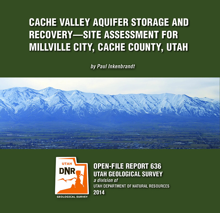
OFR-636 Cache Valley Aquifer, Cache County, Millville City

By: Paul Inkenbrandt

The City of Millville, located in a prime location for aquifer storage and recovery (ASR), is having issues with elevated nitrate in the Glenridge well, a public water supply sourced from the Cache Valley principal aquifer. To alleviate high nitrate, the city performed an initial injection and pumping test using the Glenridge well. Millville injected water from Garr Spring, another public water supply source of which they own water rights, into the Glenridge well for one week at a rate of 500 gallons per minute. They then pumped the well while monitoring geochemistry to determine the effects on the Cache Valley principal aquifer system. The pre-injection nitrate concentration in the Glenridge well was 7.65 mg/l nitrate as nitrogen, and the nitrate concentration after pumping more than 172% of the volume of water injected was 6.52 mg/l nitrate as nitrogen. There is likely some dispersion of the injected spring water via advection in the aquifer.

GET IT HERE

By: Douglas A. Sprinkel

This CD contains the geologic map at 1:50,000 scale and a 19-page booklet, both in PDF format. The map covers six 7.5-minute quadrangles in the eastern part of the Duchesne 30’x 60′ quadrangle. The quadrangle is located mostly in the western Uinta Basin, with the northwest corner located along the southwest flank of the Uinta Mountains but the area mapped is centered on Roosevelt, Utah. The map area includes surficial deposits that range from historic to lower Pleiestocene piedmont alluvium, stream alluvium, and glacial deposits. Bedrock map units include the Duchesne River and Uinta Formations. Structural features include the axis of the Uinta Basin syncline (and associated folds), the basin boundary fault zone in the northern part of the map area, and the Duchesne fault zone in the southern part of the map area. The Duchesne 30’x 60′ quadrangle also contains an array of geologic resources including minerals, phosphate, sand and gravel, and gilsonite, but energy resources are the most significant with the giant Altamont-Bluebell and Monument Butte fields located in the quadrangle.

GET IT HERE

GET IT HERE

Current Issue Contents:

• The Uinta Mountains: A Tale of Two Geographies
• In Memoriam: Lehi F. Hintze
• Students Fill the GIS Gap
• The 2014 Crawford Award
• GeoSights: Roosevelt Hot Springs Geothermal Area, Beaver County
• New Publications
• Teacher’s Corner
• Core Center News
• Glad You Asked: What are keeper potholes & how are they formed?

GET IT HERE

VIEW PAST ISSUES