ksl.com
LAKE POWELL — When veteran dinosaur tracker Andre Delgalvis first laid eyes on a giant slab of rock near Lake Powell a few weeks ago, he could hardly believe what he was seeing.
ksl.com
LAKE POWELL — When veteran dinosaur tracker Andre Delgalvis first laid eyes on a giant slab of rock near Lake Powell a few weeks ago, he could hardly believe what he was seeing.
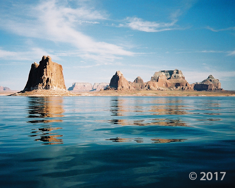
Glen Canyon National Recreation Area
Photographer: Grant Willis © 2017
Padres Butte towers over Lake Powell’s Padre Bay, both named for the Dominguez-Escalante Expedition, which crossed the Colorado River near this site in 1776. Padres and the other buttes in this area are composed of Entrada Sandstone, one of several geologic formations that form the sandstone “slickrock” that typifies much of southern Utah’s landscape.
deseretnews.com
SALT LAKE CITY — Rainbow Bridge at Lake Powell, which for centuries has inspired stories of origin, ceremonial rites and pilgrimages for multiple tribes, has been designated by the National Park Service as a “traditional cultural property” — the first in Utah.


Alstrom Point, Kane County, Utah
Photographer: Marshall Robinson; © 2016
Lake Powell’s Gunsight Bay as seen from Alstrom Point, Kane County.

Have you found him the perfect gift yet? This year, give him the gift of adventure. Check out these great books at our Map & Bookstore! A boating dad’s guide to Lake Powell.

ksl.com
A photographer who discovered thousands of dinosaur tracks at Lake Powell says it’s time to start rescuing them before his spectacular finds are destroyed.
 Red Canyon, San Juan County, Utah
Photographer: Don DeBlieux; © 2013
Wingate Sandstone cliffs at Red Canyon, east of Lake Powell, San Juan County.
 Hite Crossing vicinity, Glen Canyon National Recreation Area, Garfield and San Juan Counties, Utah
Photographer: Don DeBlieux; ©2011
Permian- and Triassic-age sedimentary rocks color the shorelines of dam-impounded Lake Powell near the confluence of the Colorado and Dirty Devil Rivers. Although the lake water has submerged numerous relicts of ancient animal (including human) and plant life, traces of prehistoric life can still be found along the lake shores and in some tributaries.
 Bluffs of Entrada Sandstone above Wahweap Bay on Lake Powell, Kane County, Utah
Photographer: Lance Weaver
One of the most photographed geologic formations in Utah if not the world, the Entrada Sandstone is the featured rock unit of Arches National Park, Goblin Valley State Park, Kodachrome Basin State Park, and parts of Glen Canyon National Recreation Area. Variations in the Entrada’s appearance across the state are due to differences in internal structure and composition as well as external stresses.
 Lake Powell, Glen Canyon National Recreation Area, Kane County, Utah
Photographer: Lance Weaver
Wahweap Bay at the south end of Lake Powell, Glen Canyon National Recreation Area.
![]()
The Utah Geological Survey (UGS) is a division of the Utah Department of Natural Resources. Several specialized programs comprise the UGS: Data Management, Energy & Minerals, Geologic Hazards, Geologic Information & Outreach, Geologic Mapping, Groundwater & Wetlands, and Paleontology.