livescience.com
In the south-central part of Utah, a 100-mile-long (161 kilometers) formation, dubbed Waterpocket Fold, has created a landscape that is not only spectacular to view but is also a geological treasure for research and study.
livescience.com
In the south-central part of Utah, a 100-mile-long (161 kilometers) formation, dubbed Waterpocket Fold, has created a landscape that is not only spectacular to view but is also a geological treasure for research and study.
Arches National Park, Grand County, Utah
Photographer: Sonja Heuscher; © 2014
The view through North Window arch in The Windows Section of Arches National Park reveals snow-covered sandstone spires and fins of the Jurassic-age Entrada Sandstone. The spires and fins result from weathering and erosion along parallel fractures, or joints, in the rock.
Hey Geology students!
community.geosociety.org
The US Geological Survey (USGS) National Cooperative Geologic Mapping Program (NCGMP) in partnership with The Geological Society of America (GSA), GSA Foundation, Association of American State Geologists (AASG), American Geosciences Institute (AGI), American Institute of Professional Geologists (AIPG), and the Journal of Maps invites students to participate in the Best Student Geologic Map Competition.
FOLLOW THIS LINK for more information!
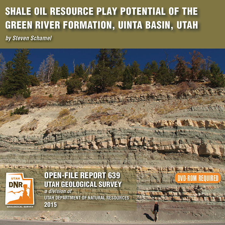
By: Steven Schamel
The Green River Formation in the Uinta Basin has may characteristics typical of an ideal shale oil resource play. It is a world-class oil-prone source rock. In nearly all parts of the basin there are many thousands of net feet of Type-l and Type-ll kerogen-rich calcareous mudstones, many intervals of which have average total organic carbon (TOC) of 5-10% or greater. In the north-central and western parts of the basin a substantial part of the formation is in the oil-generative window. Furthermore, organic maturation simulations done in this study using PRA BasinView-3D™ indicates early entry into the oil-generative window. In the northwest parts of the basin the lower Green River Formation was generating oil even before the end of the Eocene and slowing of sediment accumulation in the basin. The Green River Formation is unquestionably a superb petroleum system responsible for very large cumulative production of oil and associated natural gas, and an even larger potential oil sand resource. This DVD contains a 65-page report.
While this photo is a throwback to colder seasons, we cannot deny the stunning #UtahGeology present. This crisp, cold picture is worth a thousand hand warmers—that’s how the saying goes, right?
Dead Horse Point State Park, San Juan County, Utah
Photographer: Gregg Beukelman; © 2014
The Colorado River loops around the Gooseneck between Dead Horse Point State Park and distant cliffs of the Island in the Sky District of Canyonlands National Park. The river has carved and exposed nearly flat-lying Jurassic to Pennsylvanian-age sedimentary strata of the Colorado Plateau.
fox13now.com
Farmington Canyon will be closed for three days to allow the area to be evaluated by engineers after a large boulder fell and blocked the road Sunday.
Now that’s nothing to sneeze at!
smithsonianmag.com
With his latest work, photographer John Fowler brings a whole new meaning to the term “navel gazing.” This mosaic image, captured in late April, showcases a unique landform sometimes known colloquially as the Cosmic Navel—essentially a giant sandy pothole in Utah’s Grand Staircase-Escalante National Monument.
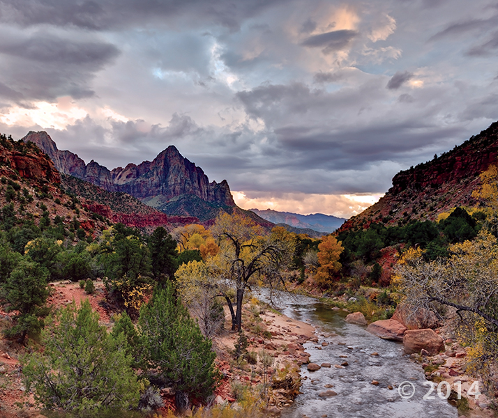
Zion National Park, Washington County, Utah
Photographer: Gregg Beukelman; © 2014
The Watchman (6,545 feet), composed of Jurassic-age Navajo Sandstone, stands guard over the southern entrance to Zion Canyon. The canyon has been carved by the North Fork Virgin River, which has eroded downward thousands of feet through the Navajo and underlying Kayenta and Moenave Formations.