

Needles District, Canyonlands National Park, San Juan County, Utah
Photographer: Adam Hiscock; © 2014
Needles District, Canyonlands National Park, San Juan County, Utah
Photographer: Adam Hiscock; © 2014

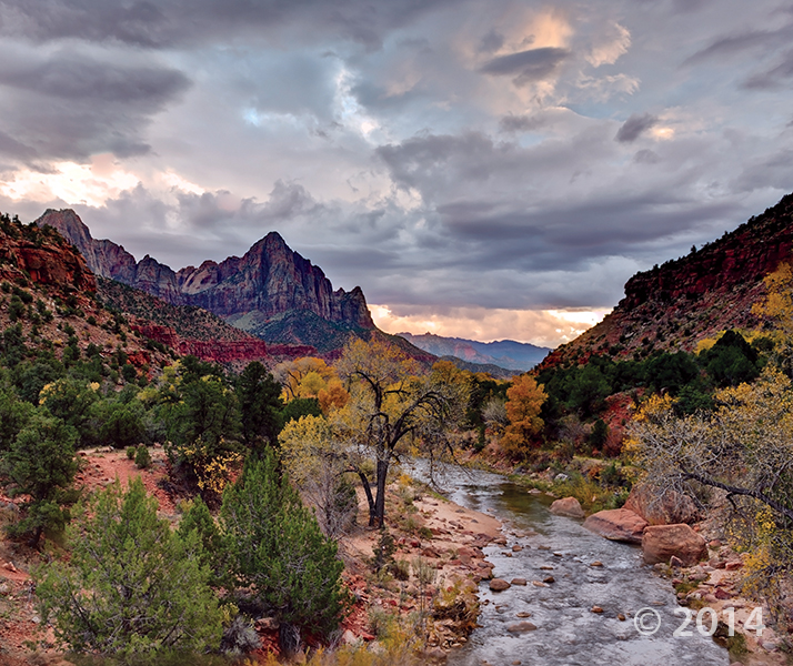
Zion National Park, Washington County, Utah
Photographer: Gregg Beukelman; © 2014
The Watchman (6,545 feet), composed of Jurassic-age Navajo Sandstone, stands guard over the southern entrance to Zion Canyon. The canyon has been carved by the North Fork Virgin River, which has eroded downward thousands of feet through the Navajo and underlying Kayenta and Moenave Formations.


Metate Arch, Devils Garden Outstanding Natural Area, Garfield County, Utah
Photographer: Ken Krahulec; © 2014


San Rafael Swell, Emery County, Utah
Photographer: Taylor Boden; © 2014
Erosion has exposed and sculpted Jurassic-age sedimentary rocks in the southern San Rafael Swell. Near Goblin Valley State Park, towering Wild Horse Butte comprises the Morrison and Summerville Formations (top cliff layers), Curtis Formation (middle slope layer), and Entrada Sandstone (bottom reddish layer).

Entrada Sandstone in Cathedral Valley, Capitol Reef National Park, Wayne County, Utah
Photographer: Tyler Knudsen; © 2014


Not everyone grows up with this kind of doll house! We’re having southern Utah geology day dreams today.
The Doll House, Maze District of Canyonlands National Park, Wayne County, Utah
Photographer: Tyler Knudsen; © 2014

House Range, Millard County, Utah
Photographer: J. Lucy Jordan; © 2014
Where’s winter? On the upside, today feels a little like this photo—it is gorgeous out there. The mid-week peak is here with another weekend on the way. Who’s got outdoor adventures in their forecast??

This photo shows another way that #UtahGeology can really knock you off of your feet. Don’t forget your sea legs as you look out over the vast sea of geology!

San Rafael Swell and Henry Mountains from Temple Mountain, Emery County, Utah
Photographer: Paul Kuehne; © 2014

Hey friends, we’ve finally made way with our new website! Visit geology.utah.gov to see our new look. Though, as most technical endeavors, we’ve encountered some difficulties. Switching the URLs erased our subscription list, and those who subscribed to our “New Blog,” you will have to re-subscribe. We apologize for the inconvenience, but we hope you’ll forgive us when you see this pretty picture of Utah geology.
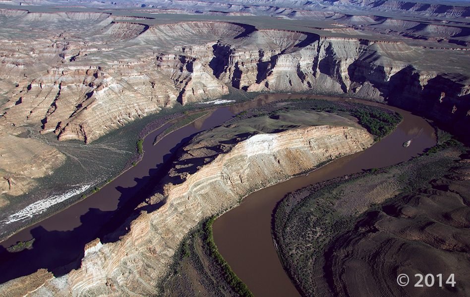
Desolation Canyon, Uintah County, Utah
Photographer: Adam Hiscock; © 2014
The Green River forms a dramatic “gooseneck” near Sand Wash in upper Desolation Canyon. The river has incised into rocks of the Douglas Creek and Parachute Creek Members of the Tertiary-age Green River Formation, which comprises sediments that accumulated in ancient Lake Uinta.

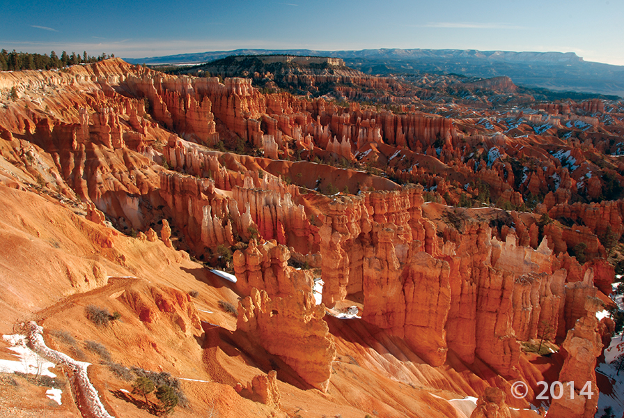
Bryce Canyon National Park, Garfield County, Utah
Photographer: Danielle Lehle; © 2014
![]()
The Utah Geological Survey (UGS) is a division of the Utah Department of Natural Resources. Several specialized programs comprise the UGS: Data Management, Energy & Minerals, Geologic Hazards, Geologic Information & Outreach, Geologic Mapping, Groundwater & Wetlands, and Paleontology.