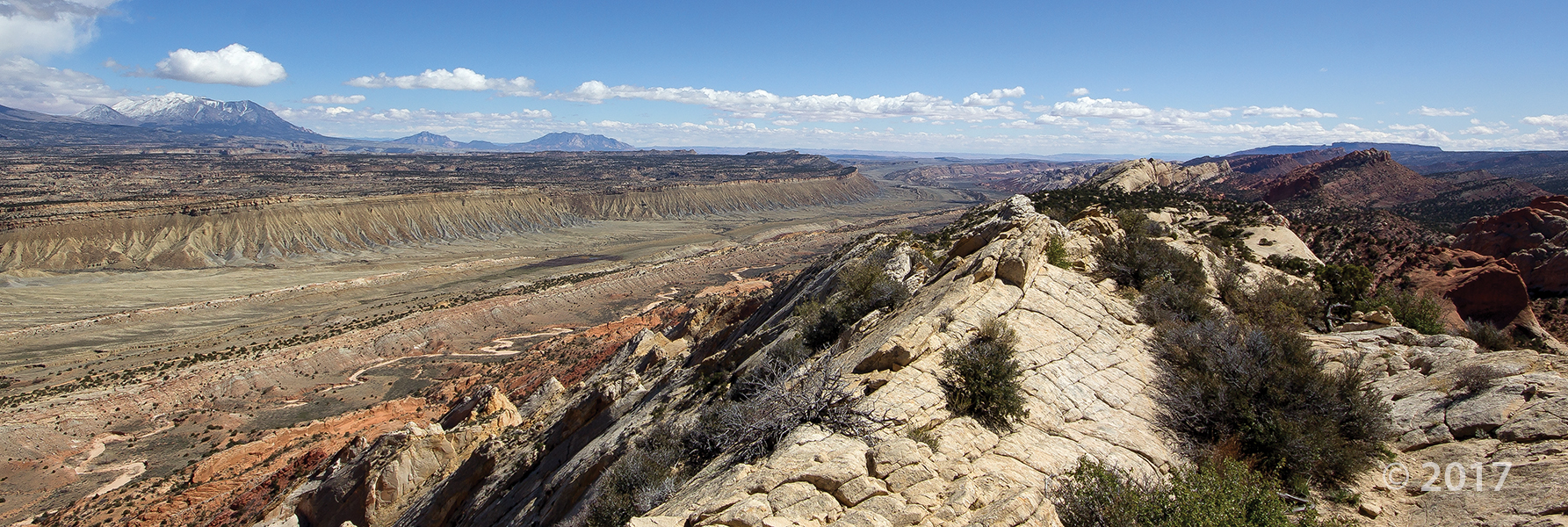
Waterpocket Fold, Capitol Reef National Park, Garfield County
Photographer: Adam Hiscock © 2017
Waterpocket Fold, Capitol Reef National Park, Garfield County
Photographer: Adam Hiscock © 2017
sltrib.com
Alongside centuries-old petroglyphs of a bear, a coyote and a bighorn sheep stand the newly etched words “DALLAS TX.”

Wishing our Tuesday was spent out there! The weather just gets nicer and nicer by the day. What Utah places do you want to explore this year?

Capitol Reef National Park, Wayne County, Utah
Photographer: Tyler Knudsen; © 2015
Fluted crimson walls of Jurassic-age Entrada Sandstone rim Cathedral Valley in the remote northern part of Capitol Reef National Park. The near-vertical Entrada walls owe their existence to the overlying white Curtis Formation that serves as a protective cap rock.


Cathedral Valley Overlook, Capitol Reef National Park, Wayne County, Utah
Photographer: Gregg Beukelman; © 2015
Light-brown sandstone of the Jurassic-age Curtis Formation caps the underlying reddish siltstone of the Entrada Formation in Cathedral Valley. In places, only boulders remain of the resistant cap rock as the Curtis Formation slowly weathers away.

We’re looking forward to 2016. What geology adventures will find you this year?

Waterpocket Fold, Capitol Reef National Park, Garfield County, Utah
Photographer: Don DeBlieux; © 2015

Another weekend already?? Well we’re not complaining! Who’s got plans to get out into Utah geology this weekend?
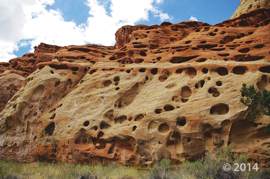
Capitol Reef National Park, Wayne County, Utah
Photographer: Adam McKean
Erosion pockets in Wingate Sandstone, Cohab Canyon, Capitol Reef National Park, Wayne County.
livescience.com
In the south-central part of Utah, a 100-mile-long (161 kilometers) formation, dubbed Waterpocket Fold, has created a landscape that is not only spectacular to view but is also a geological treasure for research and study.

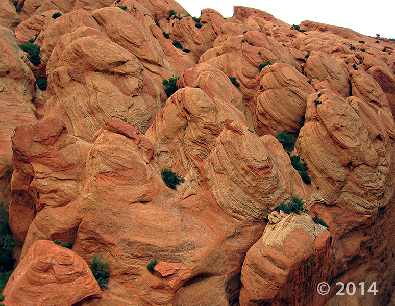
Entrada Sandstone in Cathedral Valley, Capitol Reef National Park, Wayne County, Utah
Photographer: Tyler Knudsen; © 2014
For those of our friends that can’t get out into the outdoor wonder-world this weekend, here are some stunning photos to keep you company.
travel.nationalgeographic.com
ksl.com
Utah is home to five national parks — Zion, Arches, Canyonlands, Capitol Reef and Bryce Canyon. How well can you pick out the geological features and what makes each park famous?

The Utah Geological Survey (UGS) is a division of the Utah Department of Natural Resources. Several specialized programs comprise the UGS: Data Management, Energy & Minerals, Geologic Hazards, Geologic Information & Outreach, Geologic Mapping, Groundwater & Wetlands, and Paleontology.
1594 West North Temple, Suite 3110
Salt Lake City, Utah 84116
801-537-3300 (phone)
801-537-3400 (fax)
Mailing Address:
PO BOX 146100
Salt Lake City, Utah 84114
Monday through Friday,
8 a.m. to 5 p.m.
![]()