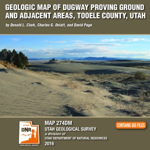
Geologic map of Dugway Proving Ground and adjacent areas, Tooele County, Utah.
By: Donald L. Clark, Charles G. Oviatt, and David Page
GET IT HERE

M-274DM Cover

Dugway Proving Ground is an expansive military installation that covers parts of the southern Great Salt Lake Desert and Government Creek Basin, and the southern Cedar Mountains, Wildcat Mountain, Granite Peak, and northern Dugway Range. The ranges contain Paleozoic marine sedimentary rocks about 28,000 feet (8540 m) thick, excepting Granite Peak- a Late Jurassic granitic intrusion. The southern Cedar Mountains volcanic field contains Eocene intermediate to silicic rocks, while the rhyolitic Sapphire Mountain lava flow is Miocene. Paleozoic rock packages are distributed among at least three thrusts sheets of the Sevier fold-thrust belt (Cretaceous to Eocene). Regional extension since about 20 million years ago has broken the area into basins and ranges along high-angle normal faults. Quaternary surficial deposits originated from the Bonneville lake cycle, and alluvial, eolian, and mixed environments. A unique feature is the Old River Bed and associated delta complex at its northern terminus, related to surface- water overflow and goundwater discharge from the Sevier basin to the Great Salt Lake basin between about 15,000 and 10,000 years ago. The delta was occupied by prehistoric humans.

Arches National Park, Grand County
Photographer: Gregg Beukelman © 2016
8-30-16
Early morning light provides a glow to one of the Courthouse Towers, an erosional remnant of a fin composed of vertically jointed Jurassic-age Slick Rock Member of the Entrada Sandstone.

smithsonianmag.com

Marie Tharp’s maps helped prove continental drift was real. But her work was initially dismissed as “girl talk”

READ MORE

smithsonianmag.com

At least 73 people died in the mountains of central Italy this morning when a magnitude 6.2 earthquake and a series of at least 40 aftershocks shook the Umbria, Lazio and Marche regions.

READ MORE

tucson.com

The uneasy transition of the Arizona Geological Survey from freestanding state agency to the University of Arizona College of Science must now proceed without the leadership of its director, M. Lee Allison.

READ MORE


100 Years: Let’s celebrate!

The National Park Service is turning 100 and everyone can take part in the celebration!

“A Family Guide to the Grand Circle National Parks” is available now at our Utah Natural Resources Map & Bookstore located on the corner of North Temple and Redwood Road in Salt Lake City.

GET IT ONLINE HERE

familyguide
Discover the national parks and programs in your own backyard!

8-23-16

Gold Basin and Mount Tukuhnikivatz, La Sal Mountains, San Juan County

Photographer: Ryhan Sempler © 2016

rferl.org

With the sale of elephant tusks under close scrutiny, “ethical ivory” from the extinct woolly mammoth is now feeding an insatiable market in China.

READ MORE

The National Park Service turns 100 on August 25, 2016.
As part of the celebration, entrance fees are waived at all National Park Service facilities from August 25 through August 28!

A complete driving map, featuring 8 National Parks is available now at the DNR Map & Bookstore. Utah.com National Parks Map & Guide

utahcommap

Join the party!

OFR-653DM cd cover

By: James C. Coogan and Jon K. King

The Ogden 30’x60′ quadrangle covers the populous Wasatch Front near Ogden, Utah, and the adjacent Wasatch Range, and extends eastward into Wyoming near Evanston, Wyoming. It covers parts of the Ogden, Weber, and upper and lower Bear River drainages. The Ogden quadrangle is economically important because of the gas and oil fields on the east margin of the map area, the cement plant near Devils Slide, numerous sand and gravel operations, water resources, and recreational interests.

GET IT HERE