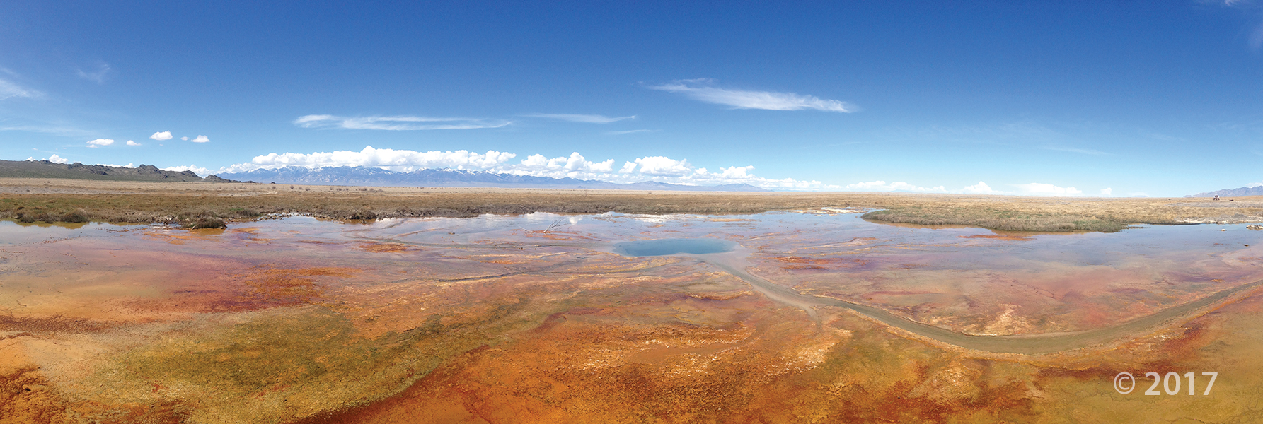
Wilson Springs, Tooele County
Photographer: Ryhan Sempler © 2017
Wilson Springs, Tooele County
Photographer: Ryhan Sempler © 2017
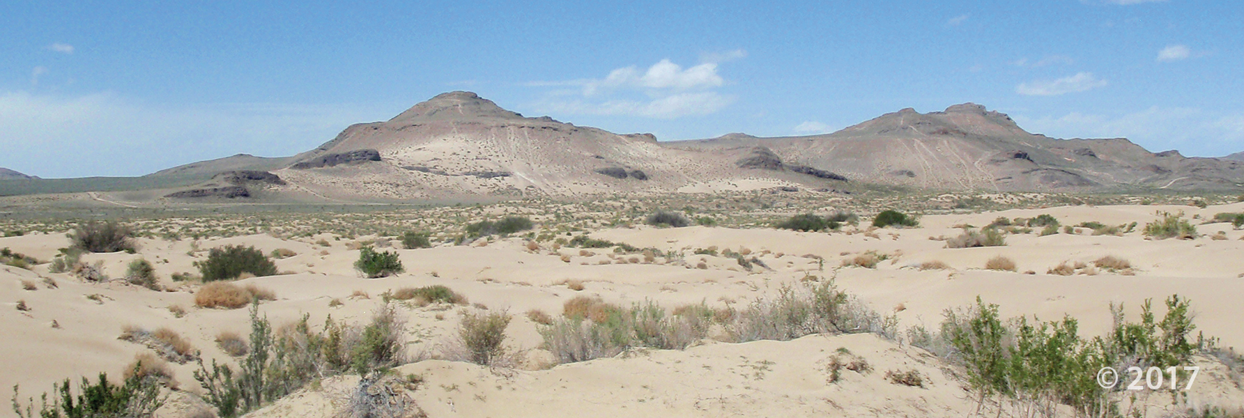
Knolls Recreation Area, Tooele County.
Photographer: Lori Steadman © 2017

Have a wonderful weekend, everyone!
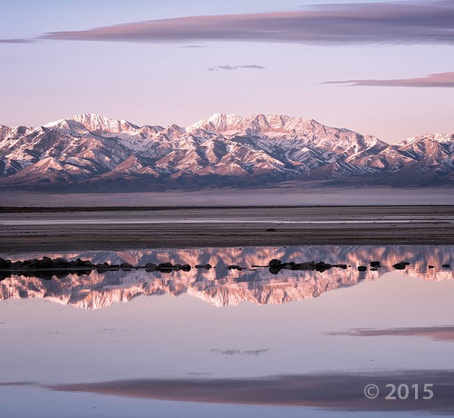
Stansbury Mountains, Tooele County, Utah
Photographer: Gregg Beukelman; © 2015
Alpenglow illuminates the glacially sculpted Stansbury Mountains as seen from the shores of Great Salt Lake. Deseret Peak (11,031 feet), the leftmost high summit, is the range’s highest peak and is underlain by Cambrian-age Prospect Mountain Quartzite.
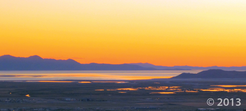

Great Salt Lake, Davis and Tooele Counties, Utah
Photographer: Mark Milligan; © 2013
Take in this photo as your day comes to a close. Sometimes a setting sun brings out the best colors in Utah Geology.
 By: Stefan M. Kirby
This map represents the geology of the Vernon NE quadrangle at 1:24,000 scale. The Vernon NE quadrangle covers a part of the floor of Rush Valley northeast of the Vernon Hills in southeastern Tooele County. Unconsolidated surficial deposits of Holocene to lower Pleistocene? age cover nearly the entire quadrangle. These deposits include various alluvial fan and channel sediments, and lacustrine units deposited during both the transgression and regression of Lake Bonneville. The Salt Lake Formation is exposed in the western half of the quadrangle as a series of topographically low outcrops partially overlain and surrounded by unconsolidated deposits. The exposed thickness of the Salt Lake Formation is up to 2850 feet (870m).
This CD contains geographic information system (GIS) files in ESRI file geodatabase and shapefile formats. Two plates, a geologic map at 1:24,000 scale and an explanation plate, and a 6-page booklet are also included in PDF format. The latest version of Adobe Reader is required to view the PDF files.
 By: Stefan M. Kirby
This map represents the geology of the Saint John quadrangle at 1:24,000 scale. The Saint John quadrangle, in southeastern Tooele County, Utah, covers a part of the floor of Rush Valley. Unconsolidated surficial deposits of Holocene to Pleistocene age cover nearly the entire quadrangle. These deposits include various alluvial fan and channel sediments, and lacustrine units deposited during both the transgression and regression of Lake Bonneville. Normal faults cut unconsolidated deposits in the western half and northeast corner of the quadrangle. In the northeast corner of the quadrangle, conjugate normal faults form a prominent horst and a series of west-facing scarps in late Pleistocene mixed alluvial and lacustrine deposits. Bedrock includes Pennsylvanian-age Oquirrh Group sedimentary rocks exposed in the southwest corner of the quadrangle, which consists of interbedded marine limestone and sandstone. Consolidated Tertiary fine-grained lacustrine basin fill of the Salt Lake Formation is exposed just north of the community of Saint John.
This CD contains geographic information system (GIS) files in ESRI file geodatabase and shapefile formats. Two plates, a geologic map at 1:24,000 scale and an explanation plate, and an 8-page booklet are also included in PDF format. The latest version of Adobe Reader is required to view the PDF files.
 Deseret Peak Wilderness Area, Stansbury Mountains, Tooele County, Utah
Photographer: Tyler Knudsen
Deseret Peak, the highest point (11,031 feet) in the Stansbury Mountains, towers over wildflower-covered slopes in upper South Willow Canyon. Deseret Peak is composed of Cambrian-age Tintic Quartzite sculpted by glacial ice during the last Ice Age.
 Great Salt Lake, Tooele County, Utah
Photographer: Tom Dempster
Solar evaporation pond at Great Salt Lake, Tooele County, Utah
 Tabbys Peak in the Cedar Mountains, Tooele County, Utah.
Photographer: Don Clark
About 40 million years ago, magma intruded to form a large dike. While cooling, the magma shrank and fractured into a six-sided column pattern, resulting in the blocky appearance of the weathered andesite at Tabbys Peak in the Cedar Mountains, Tooele County.
![]()
The Utah Geological Survey (UGS) is a division of the Utah Department of Natural Resources. Several specialized programs comprise the UGS: Data Management, Energy & Minerals, Geologic Hazards, Geologic Information & Outreach, Geologic Mapping, Groundwater & Wetlands, and Paleontology.
 GET IT HERE