Hey friends, we’ve finally made way with our new website! Visit geology.utah.gov to see our new look. Though, as most technical endeavors, we’ve encountered some difficulties. Switching the URLs erased our subscription list, and those who subscribed to our “New Blog,” you will have to re-subscribe. We apologize for the inconvenience, but we hope you’ll forgive us when you see this pretty picture of Utah geology.
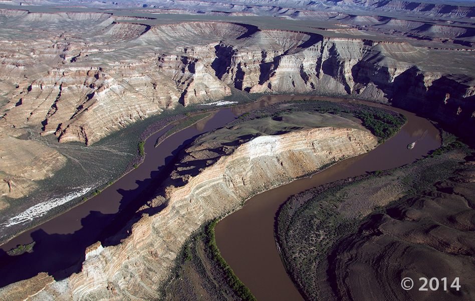
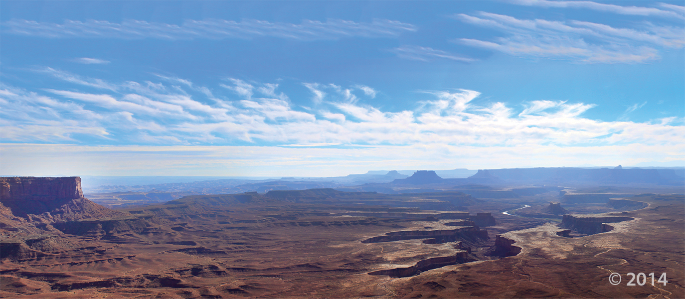
Desolation Canyon, Uintah County, Utah
Photographer: Adam Hiscock; © 2014
The Green River forms a dramatic “gooseneck” near Sand Wash in upper Desolation Canyon. The river has incised into rocks of the Douglas Creek and Parachute Creek Members of the Tertiary-age Green River Formation, which comprises sediments that accumulated in ancient Lake Uinta.