Tag Archive for: Little Cottonwood Canyon

Little Cottonwood Canyon, Wasatch Range
Photographer: Michael Vanden Berg © 2017
Alpine wildflowers color the slopes of Albion Basin at the head of Little Cottonwood Canyon. The 11,000-foot-high peaks of the central Wasatch Range owe their height to vertical movement on the Wasatch fault over the past 15 million years.


Little Cottonwood Canyon, Salt Lake County
Photographer: Adam McKean © 2017

Interbedded shale and quartzite of the Precambrian Big Cottonwood Formation are dramatically folded and faulted on the sheer face of Twin Peaks in Little Cottonwood Canyon. The intrusive Tertiary-age Little Cottonwood granite stock forms the light-gray, glaciated peaks in the distance.

Lower Red Pine Lake occupies part of a cirque basin below White Baldy (11,321 feet). Pleistocene glaciers carved the Tertiary-age granitic bedrock of the Little Cottonwood Stock into a variety of alpine landforms including cirques, arêtes, and horns. Little Cottonwood Canyon, Wasatch Range, Salt Lake County, Utah. Photographer: Taylor Boden; © 2015

POTD 2-23-16 Little Cottonwood Canyon, Wasatch Range

Little Cottonwood Canyon, Wasatch Range, Salt Lake County, Utah
Photographer: Taylor Boden; © 2015

Lower Red Pine Lake occupies part of a cirque basin below White Baldy (11,321 feet). Pleistocene glaciers carved the Tertiary-age granitic bedrock of the Little Cottonwood Stock into a variety of alpine landforms including cirques, arêtes, and horns.

Little Cottonwood Canyon, Wasatch Range, Salt Lake County, Utah
Photographer: Mike Hylland; ©2011

A sawtoothed ridge (arête) of glacially carved granitic rock separates the Maybird and Red Pine drainages. South side of Little Cottonwood Canyon, Wasatch Range, Salt Lake County.

Little Cottonwood Canyon, Wasatch Range, Salt Lake County, Utah
Photographer: Mike Hylland; ©2011

The “”wrinkled” surface of a rock glacier on the floor of Maybird Gulch hints at the Ice Age glacial activity that carved this tributary to Little Cottonwood Canyon. Ice below the ground surface, now likely all melted away, once allowed the bouldery deposit to imperceptibly flow down the valley floor, forming the arcuate ridges at the ground surface.

Little Cottonwood Canyon, Salt Lake County, Utah
Photographer: Taylor Boden

Igneous (gray) and metasedimentary (brown) rocks in Little Cottonwood Canyon, Salt Lake County, Utah.

Little Cottonwood Canyon, Salt Lake County, Utah.
Photographer: Stefan Kirby

Pfiefferhorn Peak, a glacier-carved “horn” above Little Cottonwood Canyon, Salt Lake County, Utah

Little Cottonwood Canyon, Wasatch Range, Salt Lake County, Utah
Photographer: Mike Hylland

Ice Age (late Pleistocene) glaciers carved a classic U-shaped valley into granitic rock of the Oligocene-aged Little Cottonwood stock at Little Cottonwood Canyon. Across Salt Lake Valley, the Oquirrh Mountains are home to the Bingham Canyon mine, the largest open-pit copper mine in North America.

Big and Little Cottonwood Canyons contain some of the most dramatic glacial scenery in the Wasatch Range. This article highlights some of the numerous and varied glacial features in both canyons.

Geologic Information: The Cottonwood Canyons and many of their tributaries and high-elevation basins were filled with hundreds of feet of glacial ice between 30,000 and 10,000 years ago.

The Little Cottonwood Canyon glacier reached beyond the mouth of the canyon and extended into Lake Bonneville, calving ice bergs into the Ice Age lake. The Big Cottonwood Canyon glacier, however, advanced only about 5 miles down its canyon. Presumably this was due to less snow accumulation in Big Cottonwood’s catchment area.

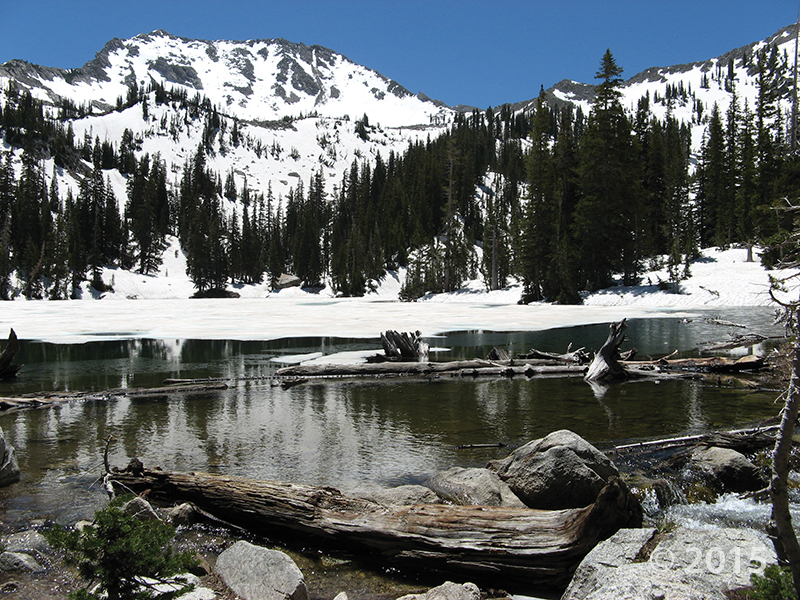
Valley (alpine) glaciers originate at the head of valleys in high mountain ranges and then flow down preexisting stream valleys. They erode and transport considerable amounts of rock debris, enabling them to significantly modify the landscape. Many distinctive erosional and depositional landforms result; however, this article addresses only the more prominent local features. Beautiful granitic rock that has been sculpted by glacial ice in both canyons enhances the spectacular rugged, mountainous scenery.

Erosional Landforms and Features: Glaciers pluck and abrade a staggering amount of rock from the canyon walls and floors, which is then carried along with the moving ice. Thus, the hefty mass of rock material and ice perform some serious erosion. The valley bottom and walls are scoured vigorously, creating a deeper and much wider U-shaped canyon—one of the most distinctive valley glacial features.

READ MORE