sltrib.com
Picture, if you will, the mighty Tyrannosaurus rex.
The odds are good what you envision has been brought to you in part by “Jurassic Park,” a plastic toy or some other facet of pop culture.
sltrib.com
Picture, if you will, the mighty Tyrannosaurus rex.
The odds are good what you envision has been brought to you in part by “Jurassic Park,” a plastic toy or some other facet of pop culture.


Gooseberry Mesa, Washington County, Utah
Photographer: J. Lucy Jordan; © 2016
Sunset on Gooseberry Mesa shines golden light on cliffs of Triassic-age Shinarump Conglomerate and the underlying slope-forming Moenkopi Formation. White cliffs and peaks in the distance are thrones and temples of Zion National Park, formed of Jurassic-age Navajo Sandstone.

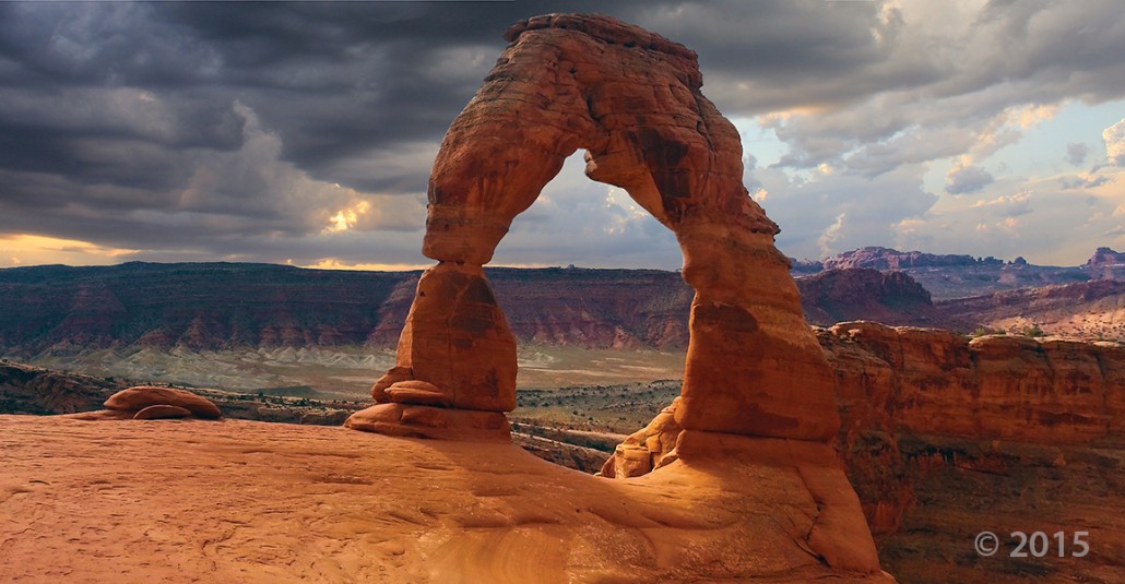
Delicate Arch, Arches National Park, Grand County, Utah
Photographer: Marshall Robinson; © 2015
Delicate Arch, a 65-foot-tall natural arch in Arches National Park, Grand County, is composed of Jurassic-age sandstone including the Slick Rock Member of the Entrada Sandstone (base and pedestals) and Moab Member of the Curtis Formation (bridge).

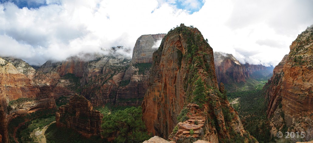
Zion National Park, Washington County, Utah
Photographer: Adam McKean; © 2015
Towering 1,488 feet above the canyon floor, Angels Landing is a joint-controlled resistant fin of Jurassic-age Navajo Sandstone, carved out by the incised North Fork Virgin River. A popular, but steep and exposed, hiking trail guides park visitors along the sheer fin to inspiring views of Zion Canyon.

Wishing our Tuesday was spent out there! The weather just gets nicer and nicer by the day. What Utah places do you want to explore this year?

Capitol Reef National Park, Wayne County, Utah
Photographer: Tyler Knudsen; © 2015
Fluted crimson walls of Jurassic-age Entrada Sandstone rim Cathedral Valley in the remote northern part of Capitol Reef National Park. The near-vertical Entrada walls owe their existence to the overlying white Curtis Formation that serves as a protective cap rock.


Cathedral Valley Overlook, Capitol Reef National Park, Wayne County, Utah
Photographer: Gregg Beukelman; © 2015
Light-brown sandstone of the Jurassic-age Curtis Formation caps the underlying reddish siltstone of the Entrada Formation in Cathedral Valley. In places, only boulders remain of the resistant cap rock as the Curtis Formation slowly weathers away.


Zion National Park, Washington County, Utah
Photographer: Adam McKean; © 2015
The setting sun illuminates the Jurassic-age Navajo Sandstone cliffs of Cougar Mountain (right) and South Guardian Angel (left) as viewed from Kolob Reservoir Road. Here, the road travels on top of the 220,000- to 310,000-year-old Grapevine Wash lava flow (dark rocks in middle ground).

The mornings are becoming a little crisper, and night comes a little quicker. It won’t belong before we see this scene!
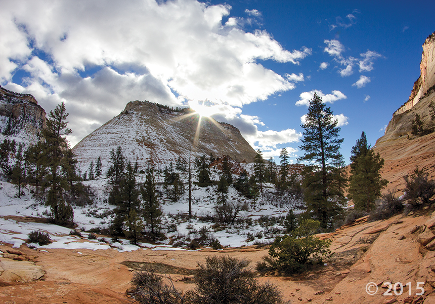
Zion National Park, Kane County, Utah
Photographer: Adam Hiscock; © 2015
Snow highlights cross-bedding on the sides of buttes and mesas along the Clear Creek drainage on the east side of Zion National Park. Cross-beds in the nearly 2,000-foot-thick Jurassic-age Navajo Sandstone formed in ancient sand dunes and reflect changing wind directions as the sand was being deposited.

While this photo is a throwback to colder seasons, we cannot deny the stunning #UtahGeology present. This crisp, cold picture is worth a thousand hand warmers—that’s how the saying goes, right?

Dead Horse Point State Park, San Juan County, Utah
Photographer: Gregg Beukelman; © 2014
The Colorado River loops around the Gooseneck between Dead Horse Point State Park and distant cliffs of the Island in the Sky District of Canyonlands National Park. The river has carved and exposed nearly flat-lying Jurassic to Pennsylvanian-age sedimentary strata of the Colorado Plateau.


Arches National Park, Grand County, Utah
Photographer: Gregg Beukelman; © 2014
Turret Arch viewed through North Window arch in The Windows Section of Arches National Park. The arches formed as the result of erosion through weak parts of sandstone fins composed of Jurassic-age Dewey Bridge Member of the Carmel Formation and Slick Rock Member of the Entrada Sandstone.
![]()
The Utah Geological Survey (UGS) is a division of the Utah Department of Natural Resources. Several specialized programs comprise the UGS: Data Management, Energy & Minerals, Geologic Hazards, Geologic Information & Outreach, Geologic Mapping, Groundwater & Wetlands, and Paleontology.