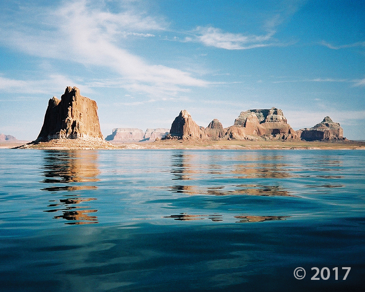
Glen Canyon National Recreation Area
Photographer: Grant Willis © 2017
Padres Butte towers over Lake Powell’s Padre Bay, both named for the Dominguez-Escalante Expedition, which crossed the Colorado River near this site in 1776. Padres and the other buttes in this area are composed of Entrada Sandstone, one of several geologic formations that form the sandstone “slickrock” that typifies much of southern Utah’s landscape.
Tag Archive for: Glen Canyon National Recreation area
 Hite Crossing vicinity, Glen Canyon National Recreation Area, Garfield and San Juan Counties, Utah
Photographer: Don DeBlieux; ©2011
Permian- and Triassic-age sedimentary rocks color the shorelines of dam-impounded Lake Powell near the confluence of the Colorado and Dirty Devil Rivers. Although the lake water has submerged numerous relicts of ancient animal (including human) and plant life, traces of prehistoric life can still be found along the lake shores and in some tributaries.
 Bluffs of Entrada Sandstone above Wahweap Bay on Lake Powell, Kane County, Utah
Photographer: Lance Weaver
One of the most photographed geologic formations in Utah if not the world, the Entrada Sandstone is the featured rock unit of Arches National Park, Goblin Valley State Park, Kodachrome Basin State Park, and parts of Glen Canyon National Recreation Area. Variations in the Entrada’s appearance across the state are due to differences in internal structure and composition as well as external stresses.
 Kodachrome Basin State Park, Kane County, Utah
Photographer: Carole McCalla
Sand pipe of Carmel Formation sediment intruded into the overlying Entrada Sandstone. One of the most photographed geologic formations in Utah if not the world, the Entrada Sandstone is the featured rock unit of Arches National Park, Goblin Valley State Park, Kodachrome Basin State Park, and parts of Glen Canyon National Recreation Area. Variations in the Entrada’s appearance across the state are due to differences in internal structure and composition as well as external stresses.
 GEOLOGIC MAP OF PART OF THE LEES FERRY AREA, GLEN CANYON NATIONAL RECREATION AREA, COCONINO COUNTY, ARIZONA
D.A. Phoenix
This CD contains a digital dataset of a geologic map of the Lees Ferry area, Arizona, and is one of several maps that together provide complete GIS geologic map coverage of Glen Canyon National Recreation Area. The Utah Geological Survey Geologic Mapping Program produced the map from U.S. Geological Survey Bulletin 1137, scale 1:24,000, published in 1963. Geographic Information System (GIS) files are provided as ESRI® file geodatabase and shapefiles. Metadata, PDF, text, and image files are included to help the user view, evaluate, and utilize the spatial data. Adobe Reader® is required to view the PDF files and can be downloaded at www.adobe.com. Specialized GIS software is required to utilize the GIS files.
CD (2 pl., 1:24,000 [contains GIS files]), ISBN 1-55791-809-0
MP-09-2DM……….$24.95


