

Metate Arch, Devils Garden Outstanding Natural Area, Garfield County, Utah
Photographer: Ken Krahulec; © 2014
Metate Arch, Devils Garden Outstanding Natural Area, Garfield County, Utah
Photographer: Ken Krahulec; © 2014

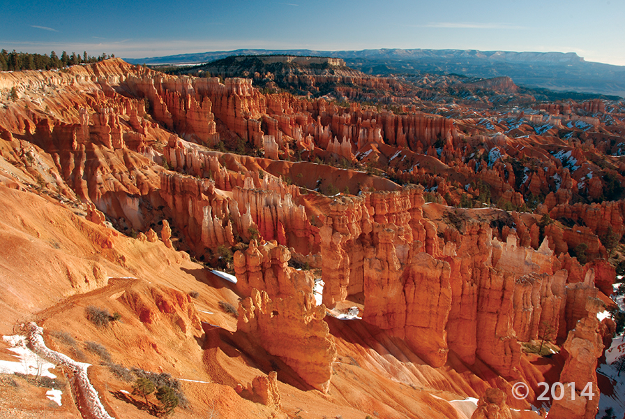
Bryce Canyon National Park, Garfield County, Utah
Photographer: Danielle Lehle; © 2014
 Grand Staircase–Escalante National Monument, Garfield County, Utah
Photographer: Michael Vanden Berg; © 2013
Iron concretions from the Navajo Sandstone, Grand Staircase–Escalante National Monument, Garfield County
 By: Robert F. Biek, John J. Anderson, Edward G. Sable, and Peter D. Rowley
The Haycock Mountain quadrangle lies in the central part of the Markagunt Plateau in southwest Utah and includes the eastern part of Panguitch Lake, a popular area of summer and winter recreational use. Despite the plateau’s relatively simple structure of a gently east-tilted fault block, the quadrangle contains scenic and instructive exposures of south-west Utah’s youngest basaltic lava flows, classic examples of inverted valleys capped by older lava flows, and the southern margin of the Markagunt Megabreccia, including newly identified, exceptionally instructive exposures of its basil slip surface. The Megabreccia is the debris of Utah’s largest catastrophic landslide deposit, which covers 1300 square miles (3400 km²) of the northern and central Markagunt Plateau.
 By: Robert F. Biek, John J. Anderson, Edward G. Sable, and Peter D. Rowley
The Panguitch Lake quadrangle lies in the central part of the Markagunt Plateau in southwest Utah and includes Panguitch Lake, a popular area of summer and winter recreational use. Despite the plateau’s relatively simple structure of a gently east-tilted fault block, the quadrangle contains scenic and instructive exposures of southwest Utah’s youngest basaltic lava flows, classic examples of inverted valleys capped by older lava flows, glacial deposits in the Castle Valley area, and the southern margin of the Markagunt Megabreccia. The Megabreccia is the debris of Utah’s largest catastrophic landslide deposit, which covers 1300 square miles (3400 km²) of the northern and central Markagunt Plateau.
 Bryce Canyon National Park from Rainbow Point, Garfield County, Utah
Photographer: Gregg Beukelman; © 2013
 Waterpocket Fold, Capitol Reef National Park, Garfield County, Utah
Photographer: Adam Hiscock; © 2013
 What a great photo to start the weekend with!
Bryce Canyon National Park, Garfield County, Utah
Photographer: Lance Weaver; © 2012
 Dixie National Forest, Garfield County, Utah
Photographer: Robert F. Biek; © 2012
Colorful volcanic sandstone and mudstone of the Brian Head Formation record initiation of volcanic activity in southwest Utah about 36 million years ago. Here, Eocene-age Brian Head deposits form rugged badlands at the south end of the Sevier Plateau.
 Henry Mountains, Garfield County, Utah
Photographer: Ken Krahulec; © 2012
Oligocene-age igneous intrusions exposed in the Henry Mountains, Garfield County.
![]()
The Utah Geological Survey (UGS) is a division of the Utah Department of Natural Resources. Several specialized programs comprise the UGS: Data Management, Energy & Minerals, Geologic Hazards, Geologic Information & Outreach, Geologic Mapping, Groundwater & Wetlands, and Paleontology.