
This warmer weather has our sights on southern Utah red rock day dreams!

The Red Mountains and the city of Santa Clara, Washington County, Utah
Photographer: J. Lucy Jordan; © 2015
This warmer weather has our sights on southern Utah red rock day dreams!
The Red Mountains and the city of Santa Clara, Washington County, Utah
Photographer: J. Lucy Jordan; © 2015


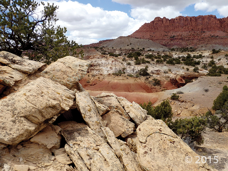
Cathedral Valley Overlook, Capitol Reef National Park, Wayne County, Utah
Photographer: Gregg Beukelman; © 2015
Light-brown sandstone of the Jurassic-age Curtis Formation caps the underlying reddish siltstone of the Entrada Formation in Cathedral Valley. In places, only boulders remain of the resistant cap rock as the Curtis Formation slowly weathers away.

Happy Groundhog Day, everyone! This photo feels as warm as Milltown Mel’s early spring prediction (compared to this morning in Salt Lake at least, brr!). What’s everyone hoping for?

Mount Timpanogos, Wasatch Range, Utah County, Utah
Photographer: Elizabeth Firmage; © 2015
Stewart Falls and the eastern slopes of Mount Timpanogos, Wasatch Range, Utah County.


Boulder Mountain, Garfield County, Utah
Photographer: Elizabeth Firmage; © 2015
Aspen groves produce spectacular fall colors high on Boulder Mountain along the east side of the Aquarius Plateau. Large, rounded boulders eroded from Tertiary-age lava flows give Boulder Mountain its name.

Another beautiful morning on the Wasatch Front with another weekend on the way. Big Cottonwood Canyon is looking a little more wintry these days!

Big Cottonwood Canyon, Wasatch Range, Salt Lake County, Utah
Photographer: Paul Inkenbrandt; © 2015
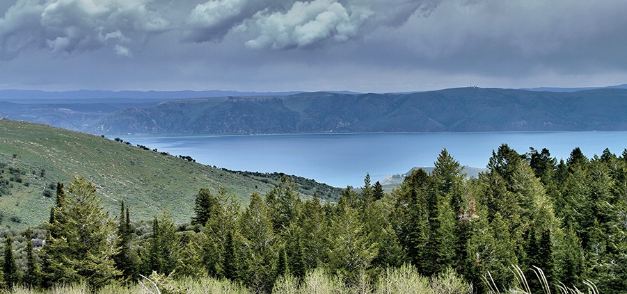
Another Tuesday winds down. Enjoy this view of Bear Lake in your outdoor daydream for the day….just don’t let the Bear Lake Monster bite!
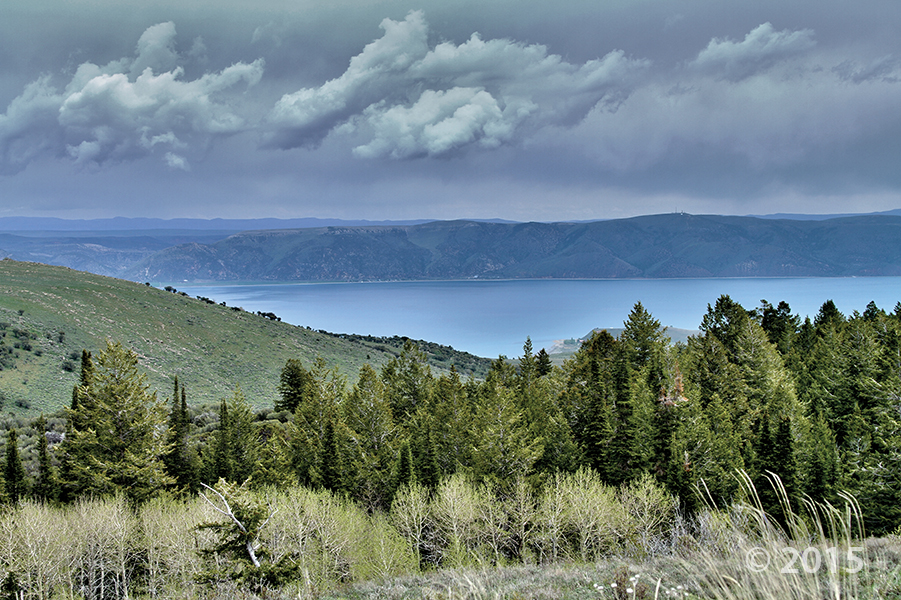
Bear Lake, Rich County, Utah
Photographer: Nikki Simon; © 2015
While it is one of the oldest lakes in North America, Bear Lake is best known for its blue splendor. The water in Bear Lake is pristine, deep, and calcium-carbonate rich, giving it a blue appearance.

We’re looking forward to 2016. What geology adventures will find you this year?

Waterpocket Fold, Capitol Reef National Park, Garfield County, Utah
Photographer: Don DeBlieux; © 2015

Merry Christmas and Happy New Year from the Utah Geological Survey! We hope all of you have enjoyed a warm and safe holiday.
Capitol Reef National Park, Wayne County, Utah
Photographer: James Kirkland; © 2015
The Late Triassic-age Chinle Formation, marked at its base by the light-colored, gravelly Shinarump Conglomerate Member, overlies red beds of the Early Triassic Moenkopi Formation. Late Triassic rocks record dramatic drying of Utah’s landscape, as drab gray floodplain deposits in the lower Chinle give way to more oxidized, reddish sand dune deposits of the cliff-forming Wingate Sandstone.

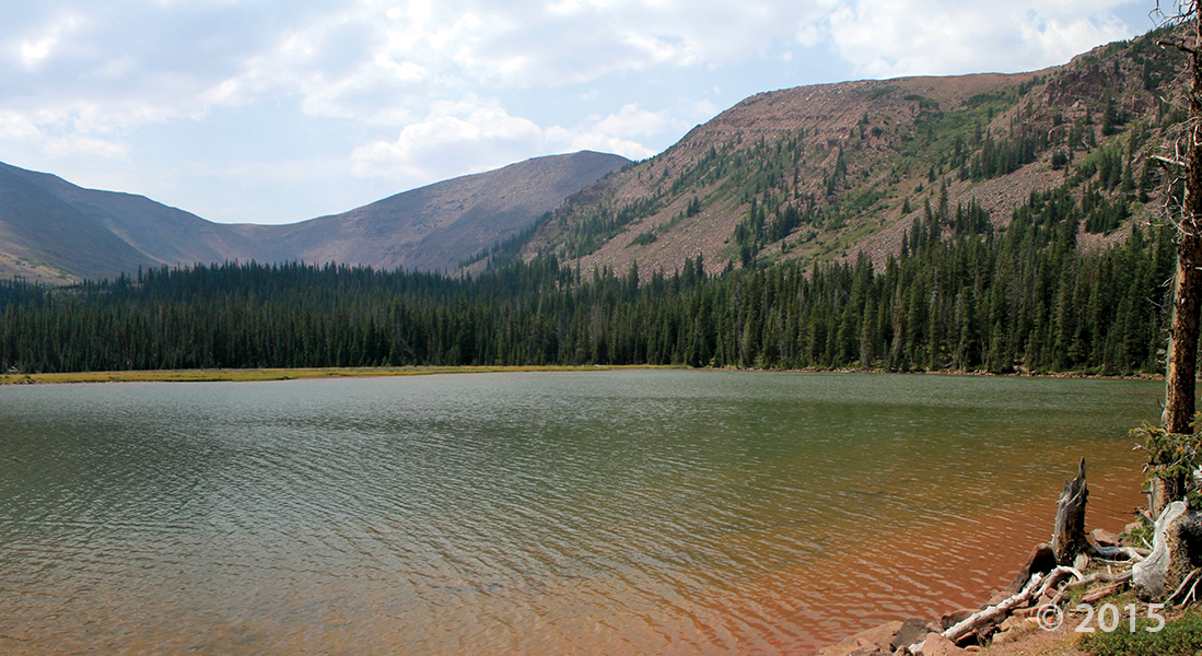
Jessen Lake, Uinta Mountains, Summit County, Utah
Photographer: Ken Krahulec; © 2015

Hoodoo you think you’re looking at, Bryce Canyon National Park?
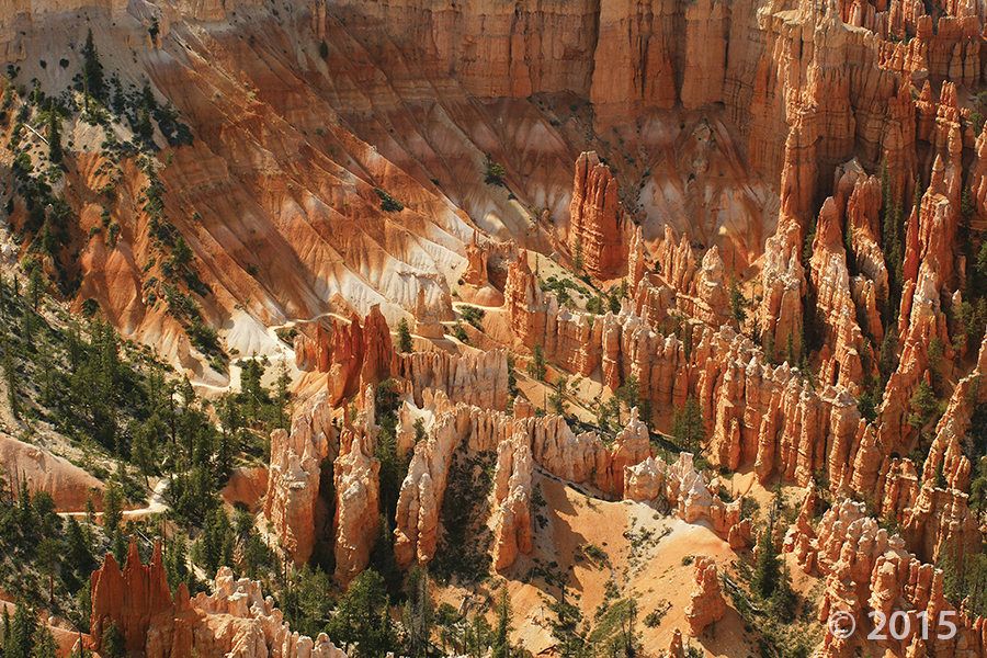
Bryce Canyon National Park, Garfield County, Utah
Photographer: Kent Brown; © 2015
Overlook from Bryce Point of fiery hoodoos in the area below Liberty Castle. Bryce Canyon hoodoos are formed in the vertically fractured pink member of the Tertiary-age Claron Formation, primarily by frost wedging and summer cloudburst rainstorms.
![]()
The Utah Geological Survey (UGS) is a division of the Utah Department of Natural Resources. Several specialized programs comprise the UGS: Data Management, Energy & Minerals, Geologic Hazards, Geologic Information & Outreach, Geologic Mapping, Groundwater & Wetlands, and Paleontology.