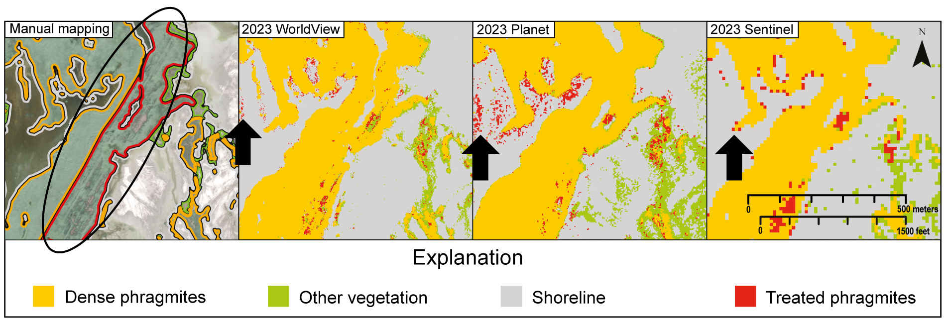
Comparison of results from manual mapping and random forest models. All approaches generally agree on dense phragmites but disagree on treated phragmites with the RF models mapping only parts of a known treatment area (black oval) but identifying patches outside treatment boundaries (black arrows).
POPULAR POSTS & PAGES
LEARN MORE ABOUT THE UTAH GEOLOGICAL SURVEY
The Utah Geological Survey (UGS) is a division of the Utah Department of Natural Resources. Several specialized programs comprise the UGS: Data Management, Energy & Minerals, Geologic Hazards, Geologic Information & Outreach, Geologic Mapping, Groundwater & Wetlands, and Paleontology.
QUICK LINKS
CONTACT INFORMATION
1594 West North Temple, Suite 3110
Salt Lake City, Utah 84116
801-537-3300 (phone)
801-537-3400 (fax)
Mailing Address:
PO BOX 146100
Salt Lake City, Utah 84114