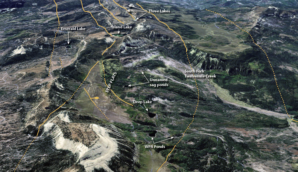
Many of the Wasatch Plateau’s lakes are visible in this aerial image looking southward along the axis of Skyline Drive east of Gunnison, Utah. Deep Lake, the WPA ponds, and many of the other unnamed lakes and ponds of the Step Flats area are sag ponds created at the head of landslides within the Twelvemile Creek drainage. Island Lake and several other small lakes along the axis of the Plateau are graben lakes bounded by normal faults. Solid and dashed orange lines are normal faults, the bar and ball symbol indicates the down-dropped side of the fault. Emerald Lake is in a Pleistocene-age glacial cirque. Aerial imagery courtesy of ESRI, Earthstar Geographics..