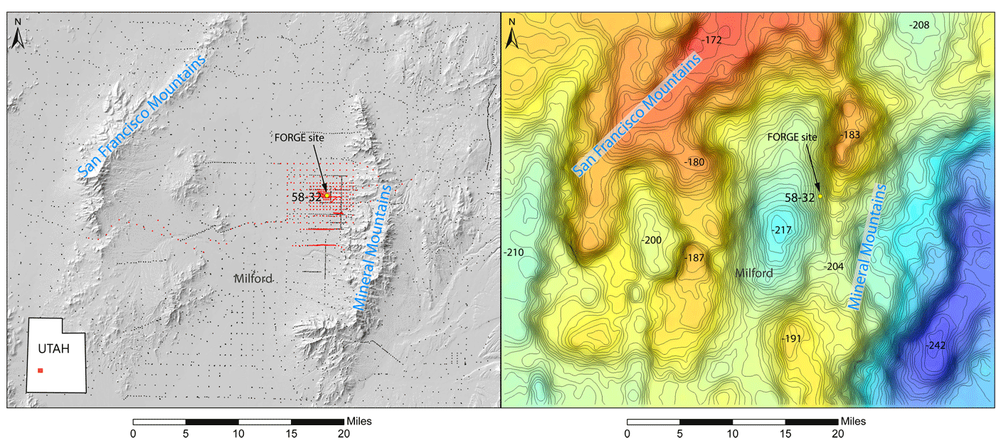
Maps of the Utah FORGE study area. Left panel: shaded elevation map showing the locations of the gravity survey stations, red dots are new stations, black dots are legacy data, FORGE well 58-32 indicated by yellow dot. Right panel: gravity anomaly field (same extent as left panel) with 1 mGal contours. Warm colors indicate gravity highs (typically mountain ranges) and cool colors are gravity lows (typically basin-fill sediments).
