
We had to turn our air conditioning on this weekend—it’s getting hot! Cool down with this photo while we thaw out our spectacular Utah Geology.
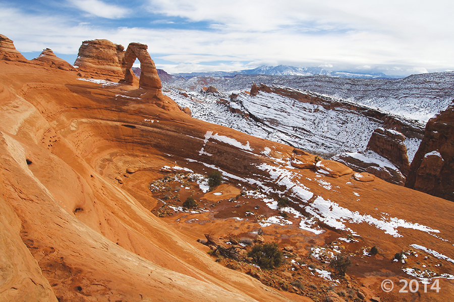
Delicate Arch, Arches National Park, Grand County, Utah
Photographer: Sonja Heuscher; © 2014
We had to turn our air conditioning on this weekend—it’s getting hot! Cool down with this photo while we thaw out our spectacular Utah Geology.
Delicate Arch, Arches National Park, Grand County, Utah
Photographer: Sonja Heuscher; © 2014


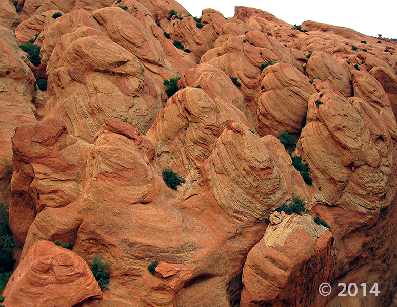
Arches National Park, Grand County, Utah
Photographer: Sonja Heuscher; © 2014
The view through North Window arch in The Windows Section of Arches National Park reveals snow-covered sandstone spires and fins of the Jurassic-age Entrada Sandstone. The spires and fins result from weathering and erosion along parallel fractures, or joints, in the rock.


Newspaper Rock petroglyph panel along Indian Creek, San Juan County, Utah
Photographer: Adam Hiscock; © 2014

While this photo is a throwback to colder seasons, we cannot deny the stunning #UtahGeology present. This crisp, cold picture is worth a thousand hand warmers—that’s how the saying goes, right?

Dead Horse Point State Park, San Juan County, Utah
Photographer: Gregg Beukelman; © 2014
The Colorado River loops around the Gooseneck between Dead Horse Point State Park and distant cliffs of the Island in the Sky District of Canyonlands National Park. The river has carved and exposed nearly flat-lying Jurassic to Pennsylvanian-age sedimentary strata of the Colorado Plateau.


Needles District, Canyonlands National Park, San Juan County, Utah
Photographer: Adam Hiscock; © 2014


Metate Arch, Devils Garden Outstanding Natural Area, Garfield County, Utah
Photographer: Ken Krahulec; © 2014


San Rafael Swell, Emery County, Utah
Photographer: Taylor Boden; © 2014
Erosion has exposed and sculpted Jurassic-age sedimentary rocks in the southern San Rafael Swell. Near Goblin Valley State Park, towering Wild Horse Butte comprises the Morrison and Summerville Formations (top cliff layers), Curtis Formation (middle slope layer), and Entrada Sandstone (bottom reddish layer).

Entrada Sandstone in Cathedral Valley, Capitol Reef National Park, Wayne County, Utah
Photographer: Tyler Knudsen; © 2014


Not everyone grows up with this kind of doll house! We’re having southern Utah geology day dreams today.
The Doll House, Maze District of Canyonlands National Park, Wayne County, Utah
Photographer: Tyler Knudsen; © 2014

Happy St. Patrick’s day, geo friends! Even the red rocks of Bryce Canyon can boast a little green.
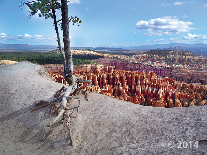
Bryce Canyon National Park, Garfield County, Utah
Photographer: Bob Biek; © 2014
Bryce Canyon National Park owes its existence to high rates of erosion by the Paria River and its tributaries, in combination with the alternating resistant and soft, jointed and fractured layers of the Tertiary-age Claron Formation. The park is adorned with a fantastic variety of hoodoos and sculpted fins eroded into the rapidly retreating Paunsaugunt Plateau escarpment.
![]()
The Utah Geological Survey (UGS) is a division of the Utah Department of Natural Resources. Several specialized programs comprise the UGS: Data Management, Energy & Minerals, Geologic Hazards, Geologic Information & Outreach, Geologic Mapping, Groundwater & Wetlands, and Paleontology.
1594 West North Temple, Suite 3110
Salt Lake City, Utah 84116
801-537-3300 (phone)
801-537-3400 (fax)
Mailing Address:
PO BOX 146100
Salt Lake City, Utah 84114
Monday through Friday,
8 a.m. to 5 p.m.
![]()