Bottleneck Peak, San Rafael Swell, Emery County
Photographer: Nikki Simon © 2016

Bottleneck Peak, San Rafael Swell, Emery County
Photographer: Nikki Simon © 2016
San Rafael Swell near Muddy Creek, Emery County
Photographer: Scott Madsen © 2016

Colorful, rounded slopes are typical of the Brushy Basin Member of the Jurassic-age Morrison Formation. Clayey bentonite beds in the Morrison often have a distinctive “popcorn” weathering texture resulting from expansion of the clay minerals when they get wet.

View from Brian Head peak, Iron County
Photographer: Paul Inkenbrandt © 2016
Markagunt Plateau, Iron County
Photographer: Tyler Knudsen © 2016

An unnamed lake fills one of countless sinkholes formed on southern Utah’s Markagunt Plateau. Dark boulders of Quaternary-age lava have collapsed into the sinkhole that is likely rooted in limestone of the underlying Tertiary-age Claron Formation.


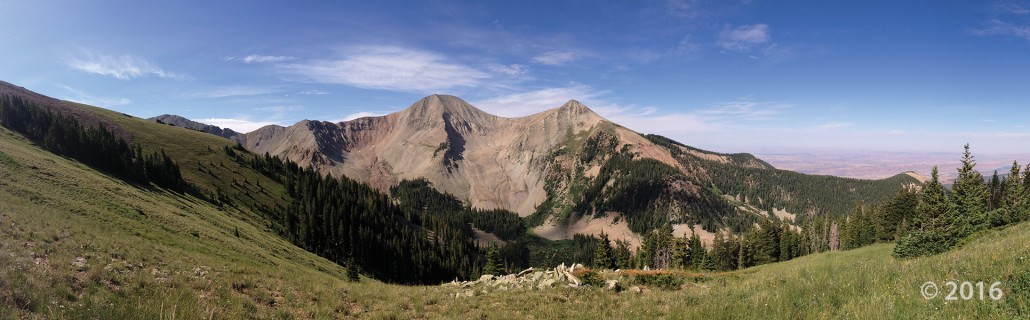
Gold Basin and Mount Tukuhnikivatz, La Sal Mountains, San Juan County
Photographer: Ryhan Sempler © 2016

Snow Canyon State Park, Washington County
Photographer: Paul Inkenbrandt © 2016

Red Castle Peak and East Red Castle Lake, Summit County
Photographer: Ryhan Sempler; © 2016
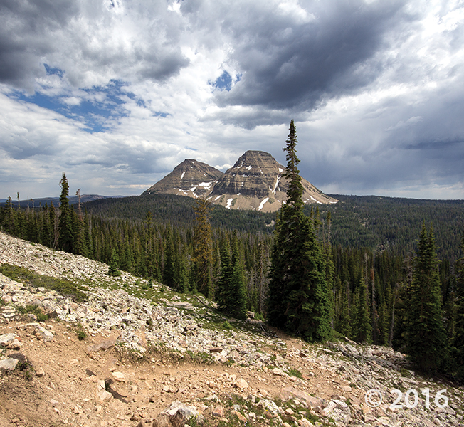
POTD July 26, 2016: Wasatch–Cache National Forest, Summit County, Utah
Photographer: Adam Hiscock © 2016
Reids Peak (11,708 feet) and Bald Mountain (11,943 feet) consist of the late Precambrian-age Mount Watson Formation, part of the Uinta Mountain Group which forms the core of the Uinta Mountains. The spectacular scenery and vistas of the Uinta Mountains result from numerous glacial cycles during the Quaternary Period.
![]()
The Utah Geological Survey (UGS) is a division of the Utah Department of Natural Resources. Several specialized programs comprise the UGS: Data Management, Energy & Minerals, Geologic Hazards, Geologic Information & Outreach, Geologic Mapping, Groundwater & Wetlands, and Paleontology.
1594 West North Temple, Suite 3110
Salt Lake City, Utah 84116
801-537-3300 (phone)
801-537-3400 (fax)
Mailing Address:
PO BOX 146100
Salt Lake City, Utah 84114
Monday through Friday,
8 a.m. to 5 p.m.
![]()