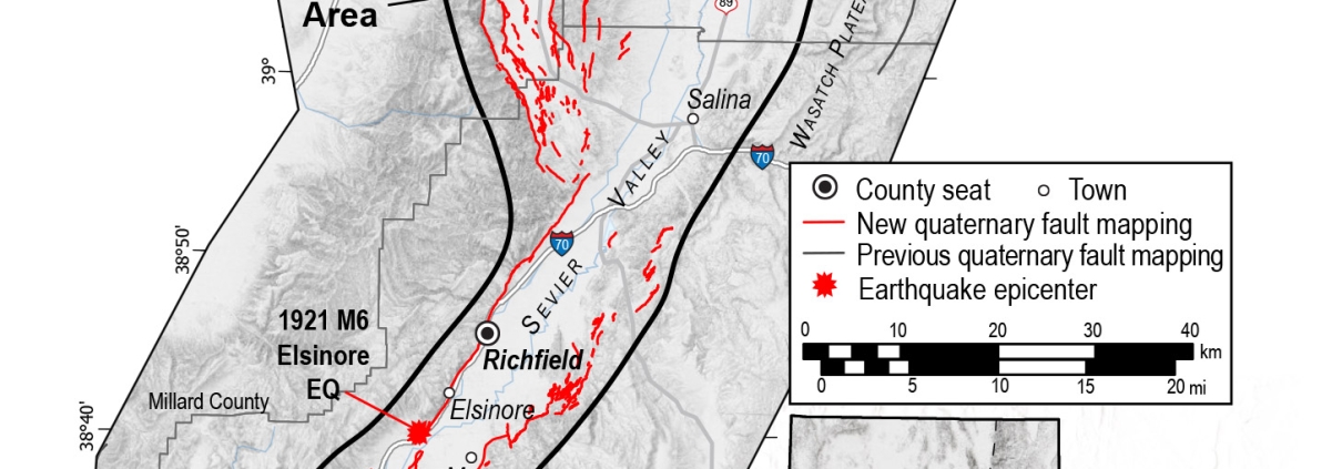
The Utah Geological Survey (UGS) announced the completion of a major hazard mapping project focused on defining active faults in central Utah. These detailed new maps provide communities, planners, and developers in one of the state’s fastest-growing rural regions with the information needed to mitigate earthquake hazards and build more resilient communities.