Rock Fall in Provo, April 11, 2009
By Ashley H. Elliott and Jessica J. Castleton
Around 11:30 a.m. on April 11, 2009, a rock fall impacted the area of 1500 North and 1550 East in Provo, Utah.
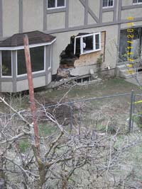
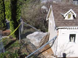
One rock-fall boulder damaged the outside of a playhouse located at 1522 North 1550 East, and another, larger boulder severely damaged a vacant house at 1496 North 1550 East.
The April 11, 2009 rock fall occurred one lot north of the May 12, 2005 “Y” Mountain rock fall.
The rock fall occurred shortly after a storm on April 8-9 that dropped 1.5 inches of precipitation in less than 18 hours at the Cascade Mountain Snotel site, 3 miles southeast of the rock-fall source area.
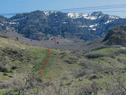
Impact craters (bounce marks) evident on the slope above the houses indicate several rocks traveled downslope. The rocks traveled an estimated one mile downslope, and likely achieved high velocities as they bounced and rolled.
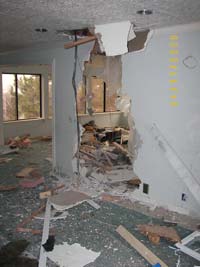
At 1496 North 1550 East, a boulder bounced over the back fence and into the back of the house. Inside the house, the boulder damaged the ceiling and crashed through a wall, before falling through the floor and into the garage door.
The source for the rock fall in both 2005 and 2009 is a cliff band in the Mississippian Deseret Limestone on “Y” Mountain about 2,600 vertical feet above the houses.
Numerous large rocks from prehistoric and historical rock-fall events are scattered throughout the neighborhood and on the hillside above, indicating these lots are in a high rock-fall hazard area.
Although the occurrence of this rock fall does not necessarily indicate a heightened rock-fall hazard under present conditions, rock falls are possible in this area at any time and typically occur with no warning, often during and following storms, periods of snowmelt, and earthquakes.
This report is preliminary (04/16/09) and subject to revision; it is presented here to facilitate a timely release of pertinent information.


