Tag Archive for: Garfield County

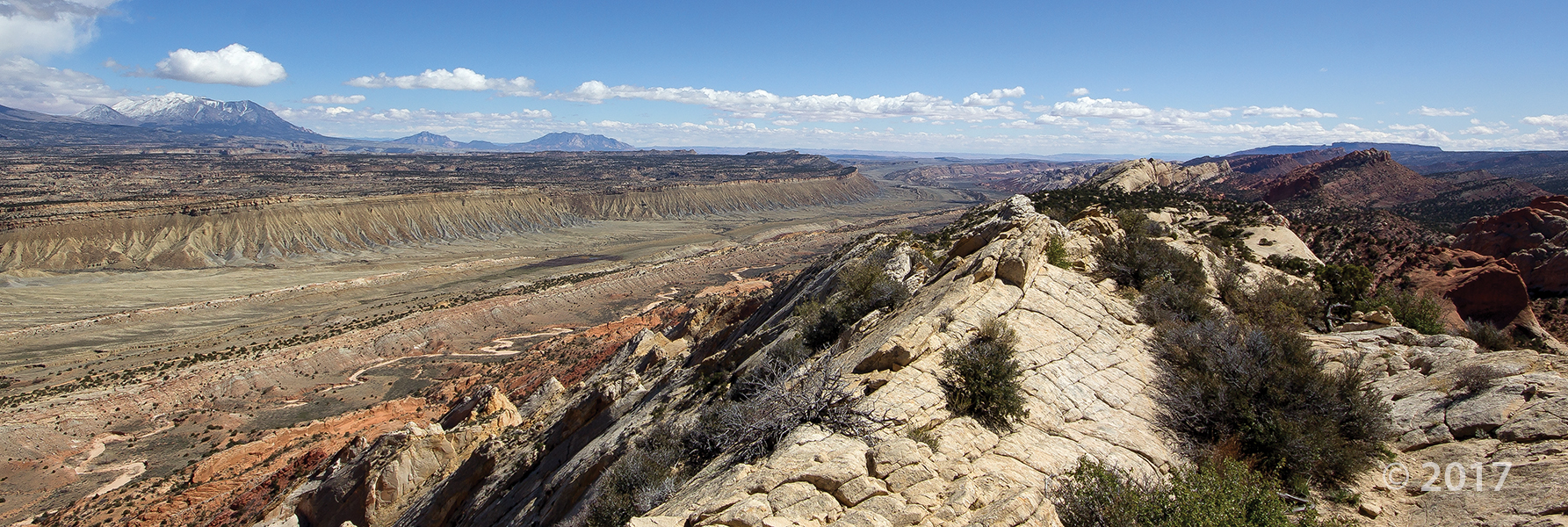
Western Garfield County
Photographer: Bob Biek © 2017
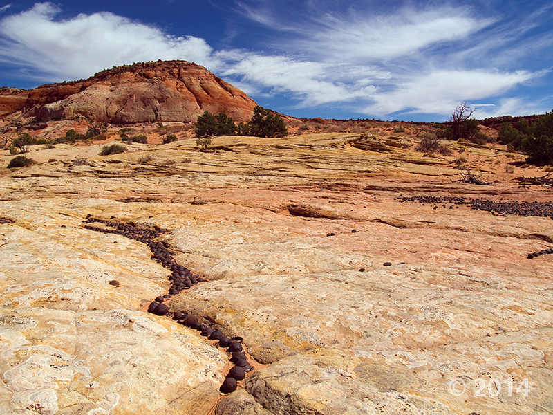
Basaltic lava flows produce stark, bouldery slopes near Panguitch Lake. The rugged, blocky lava flows are among the youngest in Utah, and erupted from nearby Miller Knoll cinder cone and adjacent vents.

Waterpocket Fold, Capitol Reef National Park, Garfield County
Photographer: Adam Hiscock © 2017

Tertiary-age Claron Formation erodes into rugged and dramatic canyons near Red Canyon, Garfield County.
Photographer: J. Lucy Jordan © 2016

12-6-16

Hoodoo consisting of Jurassic-age Entrada Sandstone, Devils Garden, Garfield County.
Photographer: Marshall Robinson © 2016.

11-29-16

Just above its confluence with the Dirty Devil River, Happy Canyon deeply and abruptly cuts and sculpts the White Rim Sandstone of the Permian-age Cutler Formation. Happy Canyon, Garfield County, Utah Photographer: Gregg Beukelman; © 2016

POTD 5-17-16 Happy Canyon Garfield County

Happy Canyon, Garfield County, Utah
Photographer: Gregg Beukelman; © 2016

Just above its confluence with the Dirty Devil River, Happy Canyon deeply and abruptly cuts and sculpts the White Rim Sandstone of the Permian-age Cutler Formation.

Pinnacles eroded from Tertiary-age lava flow breccia along State Route 20, Garfield County.

POTD 4-12-16 lava flow Garfield County

State Route 20, Garfield County, Utah
Photographer: Bob Biek; © 2015

Pinnacles eroded from Tertiary-age lava flow breccia along State Route 20, Garfield County.


Aspen groves produce spectacular fall colors high on Boulder Mountain along the east side of the Aquarius Plateau. Large, rounded boulders eroded from Tertiary-age lava flows give Boulder Mountain its name. Boulder Mountain, Garfield County, Utah. Photographer: Elizabeth Firmage; © 2015

POTD 1-26-16 Boulder Mountain

Boulder Mountain, Garfield County, Utah
Photographer: Elizabeth Firmage; © 2015

Aspen groves produce spectacular fall colors high on Boulder Mountain along the east side of the Aquarius Plateau. Large, rounded boulders eroded from Tertiary-age lava flows give Boulder Mountain its name.

Waterpocket Fold, Capitol Reef National Park, Garfield County, Utah Photographer: Don DeBlieux; © 2015

We’re looking forward to 2016. What geology adventures will find you this year?

POTD 1-5-15 Capitol Reef National Park Garfield County

Waterpocket Fold, Capitol Reef National Park, Garfield County, Utah
Photographer: Don DeBlieux; © 2015

Overlook from Bryce Point of fiery hoodoos in the area below Liberty Castle. Bryce Canyon hoodoos are formed in the vertically fractured pink member of the Tertiary-age Claron Formation, primarily by frost wedging and summer cloudburst rainstorms. Bryce Canyon National Park, Garfield County, Utah Photographer: Kent Brown; © 2015

Hoodoo you think you’re looking at, Bryce Canyon National Park?

SONY DSC

Bryce Canyon National Park, Garfield County, Utah
Photographer: Kent Brown; © 2015

Overlook from Bryce Point of fiery hoodoos in the area below Liberty Castle. Bryce Canyon hoodoos are formed in the vertically fractured pink member of the Tertiary-age Claron Formation, primarily by frost wedging and summer cloudburst rainstorms.

Hematite concretions eroded from the Navajo Sandstone. Grand Staircase–Escalante National Monument, Garfield County, Utah Photographer: Michael Vanden Berg; © 2014

POTD 7-21-15 hematite concretion Grand staircase-escalante

Grand Staircase–Escalante National Monument, Garfield County, Utah
Photographer: Photographer: Michael Vanden Berg; © 2014

Hematite concretions eroded from the Navajo Sandstone.